
Babiná: Historic Townscape, Trails and Landscape
Accommodation in Babiná
On 25 September 2000, a heritage conservation zone was designated in Babiná. The protected historic zone features an organic, clustered street-settlement structure with an irregular layout. Two levels must be distinguished here: the form of the settlement area and the individual buildings, fixtures, and archaeological finds. This distinction preserves the different historical references without reducing the settlement structure to a single building.
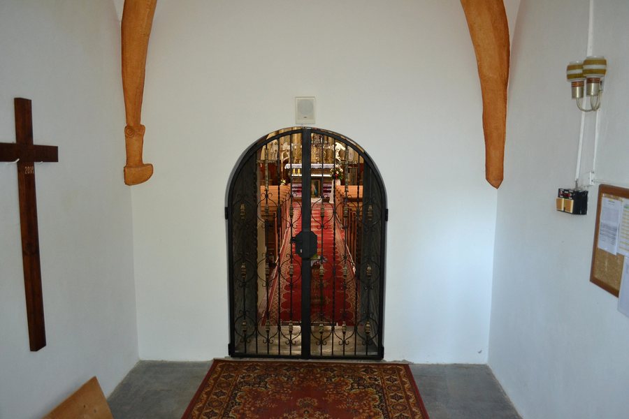 File:Babiná - Kostol sv. Matúša - interiér -d.jpg
Photo: Ladislav Luppa via Wikimedia Commons, CC BY-SA 4.0
File:Babiná - Kostol sv. Matúša - interiér -d.jpg
Photo: Ladislav Luppa via Wikimedia Commons, CC BY-SA 4.0
For accommodation in Babiná, you can compare travel dates, room categories, and cancellation policies on the respective offer pages. This information helps you match your desired travel period and selected room type with the conditions of the respective offer.
Other places: Bacúrov, Pliešovce, Dubové, Ostrá Lúka, Zvolen, Lieskovec, Sása, Podzámčok
Historic Townscape and Sacred Architecture
The Roman Catholic Romanesque Church of St. Matthew in Babiná was built between 1242 and 1254. It contains a Romanesque stone baptismal font from the 13th century. It also has a Gothic bell from 1358 with a Gothic inscription. The construction period, baptismal font, and bell provide separate chronological reference points; at the same time, the architectural styles mentioned—Romanesque and Gothic—differ.
The traditional farmhouse in Babiná was built in 1820. It has a U-shaped layout; farm buildings erected later supplement the complex. These include granaries, stables, and a barn. The architectural context can be understood through the layout and the building types added later.
Archaeology and Landscape
The Pod múrom archaeological site in Babiná contains pottery shards and bronze objects from the later prehistoric period. Here, the chronological point of reference is an archaeological site, not a building. It forms a separate reference point alongside the church, traditional farmhouse, and protected zone.
The panoramic views from Babiná’s protected historic zone are complemented by the surrounding landscape of the Štiavnické vrchy. For personal planning, you can consider the cultural connection to the village and the connection to the landscape as two related but non-identical topics.
Hiking Trails and Cycling Network
The centre of Babiná is a hiking-trail hub, particularly for the Rudná magistrála. Beside the central children’s playground stands a wooden information board showing the entire cycling network of the PK microregion. The network comprises three routes in green, blue, and yellow; the routes connect the municipalities of the microregion. Together, the three cycling routes are 36.30 kilometres long. Route colours, connections, and total length describe different points of orientation. A colour indication serves a different purpose than a total kilometre figure.
The traditional “Chotárom obce” hiking march takes place annually and leads along forest paths and meadows to remote parts of the Babiná municipal area. Its route, surface, and recurring schedule distinguish this event from a general trail description. For you, the information on hiking and cycling remains separately readable by activity, scope, and route.
For the overarching travel overview: Zvolen District.

