
La Coma – Ridge, Church and Cardener Source
Accommodation in La Coma
La Coma is situated at an elevation of 1,009 m above sea level on a rocky ridge above the narrow valley of the Cardener River. The church, source area and paths form distinct local features.
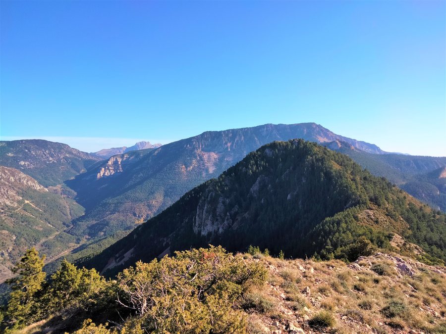 File:Roca de Migdia (La Coma i la Pedra).jpg
Photo: Catalaalatac via Wikimedia Commons, CC BY-SA 4.0
File:Roca de Migdia (La Coma i la Pedra).jpg
Photo: Catalaalatac via Wikimedia Commons, CC BY-SA 4.0
The elevation, rocky terrain and narrow river valley below shape the spatial description of the town centre. As a result, in La Coma the settlement location and river landscape appear directly as interconnected, yet clearly distinguishable elements.
Culture
The parish church of Sant Quirze i Julita stands on La Coma’s main square. It was first mentioned in a document dating from 1040. Wrought-iron fittings from the former Sant Quirze i Julita church have been preserved at the entrance to the monument. La Coma’s historic town centre has been completely renovated.
The church thus combines a clearly named location, an early date and a preserved detail from the former church. Together with the renovated historic town centre, this creates a cultural section that encompasses both the present-day appearance of the town and its recorded history.
Nature
The Fonts del Cardener are located in the immediate vicinity of La Coma. The area around the source of the Cardener is a recreational area prepared for visitors. The recreational area at the Fonts del Cardener is equipped with tables, benches, barbecue areas with spark arresters, public toilets and an unattended car park. During the snowmelt, water emerges from between the rocks at the Fonts del Cardener, often in the form of cascades.
A natural water source and a specifically prepared environment therefore meet in the source area. Tables, benches, barbecue areas, toilets and a car park are part of this area’s facilities; the water emerging between the rocks, by contrast, describes a seasonal natural scene during the snowmelt. The two groups of features remain separate.
Hiking
The Ruta del Contraban hiking route passes over Coll de Port and ends in La Coma. On the Camí Verd de la Vall de Lord, there is an opportunity to visit La Coma at a trail junction.
The two routes mentioned therefore follow different courses: the Ruta del Contraban is described as passing via Coll de Port with La Coma as its endpoint, while the Camí Verd de la Vall de Lord includes the town at a trail junction. The references to the town consequently lie at different points along the respective routes.
The hiking topics supplement the description of the town and source with two specific names: Coll de Port and Vall de Lord. In this way, the named landscape and route references of the two trails become visible alongside the destination, without combining them into a single route.
Connections
Within the municipal area of la Coma i la Pedra, an ALSA bus service connects the town with Solsona.
For accommodation for a skiing holiday in La Coma, travel dates, room category and cancellation conditions can be considered as distinct details on booking pages. These three aspects supplement the location information with the framework of the planned stay, without mixing the features of the church, source or trails.
Connections
For the higher-level travel overview: Lleida.

.jpg)