
Povrazník – Poľana, History and Hiking Trails
Accommodation in Povrazník
The cadastral area of Povrazník belongs to the Poľana Biosphere Reserve. Poľana is the highest and best-preserved volcanic mountain range in Slovakia. Among mineralogists, Povrazník is known for deposits of wood opals that formed near Poľana during volcanic activity. The volcanic cave Ďuríkova diera is also located nearby. The area around Povrazník is considered a popular mushroom-picking region.
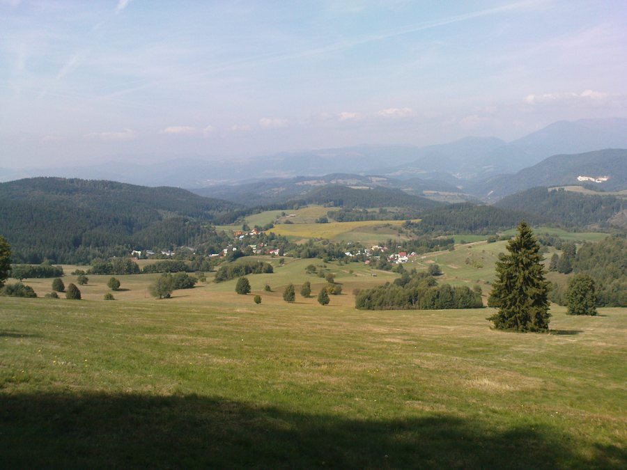
Other nearby places for orientation include Tajov, Nemce, Poniky, Spania Dolina, Podkonice, Priechod, Harmanec and Medzibrod.
History and Local Character
The first written mention of Povrazník dates from May 22, 1424; at that time, the village appears as Powraznik among the villages belonging to the Ľupča estate. The history of Povrazník is closely connected with mining. The inhabitants specialized in making ropes, which were supplied mainly to the mines of Ľubietová, Špania Dolina, and Staré Hory.
Below Brezina, on the road to Majer, there are three large rocks, each weighing about one ton and featuring centrally positioned holes approximately 15 to 20 centimeters in diameter. Stakes were secured there; long bundles of hemp fibers were twisted from rock to rock and braided into ropes used to lower miners into the pits. Linen and rag rugs were still being woven in Povrazník until the mid-20th century. The village's traditional costume belongs to the Poniky variant of the Detva costume type.
Several wooden log houses and original ethnographic artifacts have been preserved in Povrazník. Log house No. 59 dates from 1880 and is listed as a cultural monument. The bell tower has a masonry ground floor and a wooden upper floor built using a post-and-beam construction with board cladding. It contains a small bell from 1745 and a large bell from 1792; in 1928, a memorial plaque dedicated to General Dr. M. R. Štefánik was unveiled on the bell tower.
The municipal museum of Povrazník opened in 2008. It contains restored exhibits collected mainly by local residents, including a room dedicated to folk traditions, a classroom, and a collection of televisions and radios.
Hiking and Cycling Routes
Routes of significantly varying lengths are available for hiking. The marked route from Na Mincu via the main ridge of the Poľana to Detva is 25 kilometers long, involves 860 meters of elevation gain, and is considered challenging. The unmarked route through Driekyňa from Povrazník, by contrast, is 5 kilometers long, involves 130 meters of elevation gain, and is considered easy. The different distances, elevation gains, and difficulty ratings make it easier to compare the routes when planning your day.
Two different routes are also described for cycling. The cycling route from Povrazník to Slovenská Ľupča is 10 kilometers long, involves 80 meters of elevation gain, and is considered easy. The green cycling route No. 5551 runs around the Poľana, is approximately 122 kilometers long, and is considered challenging.
Transport Connections
Povrazník has a bus connection to Banská Bystrica.
For the broader travel overview: Banská Bystrica District.

