
Ústí Nad Orlicí District: Hotels and Accommodations
Accommodation in Ústí Nad Orlicí District
In the eastern part of Ústí Nad Orlicí District, the Orlické hory extend to Suchý vrch at 995 meters and Buková hora at 958 meters. The northeastern part is formed mainly by the Králický Sněžník massif.
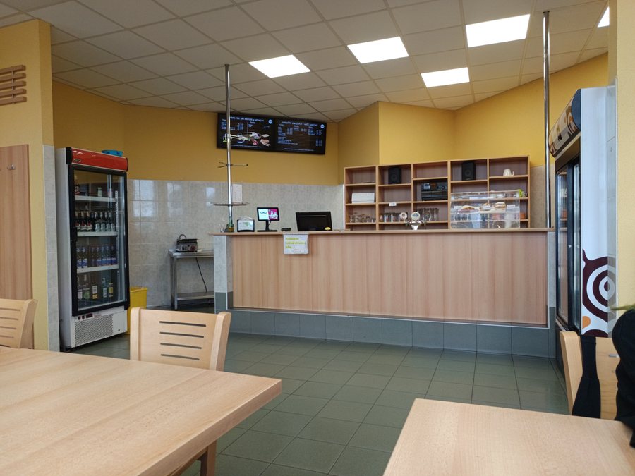 File:Občerstvení u čerpací stanice Tank ONO Vysoké Mýto, Voštice, Vysoké Mýto, okres Ústí nad Orlicí, Pardubický kraj, Česko 2026.jpg
Photo: Photo: Fry72 (Karel Frydrýšek)
File:Občerstvení u čerpací stanice Tank ONO Vysoké Mýto, Voštice, Vysoké Mýto, okres Ústí nad Orlicí, Pardubický kraj, Česko 2026.jpg
Photo: Photo: Fry72 (Karel Frydrýšek)
If you want to find and book a hotel in Ústí Nad Orlicí District, searching for accommodation is a separate part of your personal travel planning.
Landscape
The district lies on the European watershed. Its most important rivers include the Tichá Orlice, Divoká Orlice, Třebovka, and Moravská Sázava. The Pastvinská reservoir is the district’s largest body of water and covers 110 hectares.
The climate varies significantly with elevation: Vysokomýtsko is the warmest and driest area, while Lanškrounsko is cooler and wetter. Králicko and the higher-altitude Žambersko are among the coldest and wettest parts of the Pardubický kraj.
Forests cover 31.9 percent of the district—the highest proportion among the districts of the Pardubický kraj. The central and northern foothill and upland areas without larger settlements are among the least human-influenced areas of the Pardubický kraj.
Culture and History
Litice Castle stands on a hill in a bend of the Divoká Orlice, surrounded by extensive forests. Under Jiří of Poděbrady, it was extensively rebuilt by 1468 and developed into one of the most important fortresses in Bohemia in the 15th century.
The Městské muzeum Králíky documents the history of Králicko and displays collections of nativity scenes, minerals, insects, birds, and mammals. It also hosts exhibitions, lectures, and concerts; the museum also includes an information center.
The Military History Educational Trail in Králíky connects the Hůrka artillery fortress, the Military Museum Králíky, a lookout point, and the K-S 14 infantry bunker. The Military Museum Králíky can be reached by train to Prostřední Lipka station and then via a footpath of approximately 300 meters.
The Letohrad Craft Museum presents historic food-production trades, including milling, baking, cheese-making, butter-making, soda-water production, and beekeeping. A moving display with 25 carved craftsmen demonstrates 15 trades. The exhibition also includes more than 100 historic nativity scenes; nearly half of them were made by carvers from Králicko.
Routes and Activities
The Stations of the Cross beyond the Tichá Orlice leads along a forest path toward Andrlův chlum and comprises 14 stations. Stations I to XI are small chapels, while Stations XII to XIV are larger chapels. Station XIII is the Kalvárie Chapel, and Station XIV is the Božího hrobu Chapel.
A seven-kilometer hiking route from Ústí nad Orlicí reaches the Andrlův chlum lookout point via the Stations of the Cross. Lanšperk Castle also stands on a wooded hill above the valley of the Tichá Orlice. It is a ruin and was probably founded in the mid-13th century.
The Pastviny Dam offers pedal-boat rides, boating, stand-up paddleboarding, and fishing. In the regional context of Orlicko-Třebovsko, cycling, inline skating, canoeing, activities in a high-rope park, and use of a climbing wall are also available. The Choceň–Ústí nad Orlicí–Letohrad cycling route is listed in the Orlicko-Třebovsko area.
The Geologic and Water Museum in Nature has an educational station at the Klopotský spring.
Other Places
Other location pages: České Petrovice, Sobkovice, Cenkovice, Cervená Voda, Jablonne Nad Orlici, Vyprachtice, Dolní Morava, Horni Lipka
Lichkov, Mladkov, Nekor, Dolni Orlice, Jamne Nad Orlici, Kraliky, Valterice, Vlckovice
Těchonín, Bystřec, Cotkytle, Horní Čermná, Horní Hermanice V Cechách, Orličky, Verměřovice, Studené
Horní Heřmanice, Mistrovice, Šedivec, Horní Morava
For the higher-level travel overview: Pardubice.
