
Malinová: Hilly Landscape, Trails and Gold Mining History
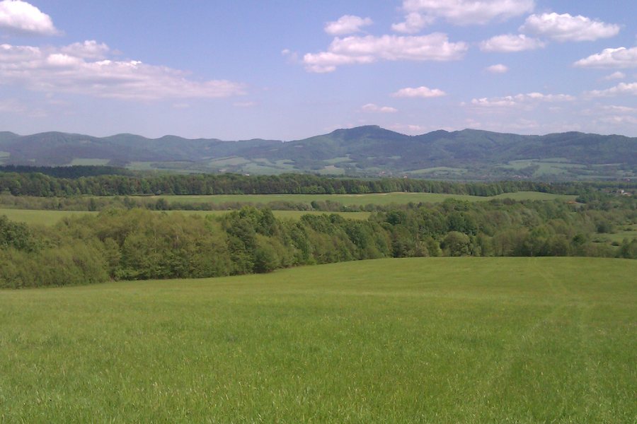 File:972 13 Malinová, Slovakia - panoramio (1).jpg
Photo: Branik P via Wikimedia Commons, CC BY-SA 3.0
File:972 13 Malinová, Slovakia - panoramio (1).jpg
Photo: Branik P via Wikimedia Commons, CC BY-SA 3.0
Malinová is a foothill municipality situated in a deforested hilly landscape with numerous alluvial fans. The forests consist of fir-beech stands and are locally supplemented by pine and spruce.
More destinations: Valaská Belá, Liešťany, Tužina, Ráztočno, Opatovce Nad Nitrou, Kanianka, Malá Čausa and Nitrianske Pravno.
When comparing accommodation in Malinová, you can compare the travel period, room category and cancellation conditions on the offer pages. These fields help you assess different options under the same conditions, while trails, landscape and culture remain separate considerations when choosing a location.
Nature and Trails
The nature around Malinová offers suitable conditions for hiking and mushroom picking. The 2.5-kilometre nature trail takes visitors to Roboty.
It starts in the village centre at the bus stop, passes through the village and forest, and ends at the edge of extensive meadows at the foot of the Strážovské vrchy; large orchards once stood there. The forest section is varied but not difficult and is also suitable for children.
The nature trail and bunker route can be considered separately based on their length, course, elevation gain and endpoint. You can weigh up different route data and activities side by side.
The Pravnianska radiála cycling route passes through Malinová.
History
Roboty, also known as Kamenné moria, are a permanent reminder of the historic gold mining in Malinová. At the beginning of the 17th century, there were gold mines in Malinová. In 1648, approximately 700 g of gold dust was extracted in Malinová.
The Mlynský kameň is a preserved relic of a former mill where flour was milled for the entire village.
Remembrance
The partisan bunker near Malinová is a reconstructed representation of a bunker built by partisans of the Ernest Thälmann unit in 1944 during the Second World War. After the partisan bunker was restored for the second time in 2018, an information board was installed there; it briefly explains the partisan resistance and the history of Malinová.
From the bus stop in Malinová, the route to the partisan bunker is signposted with a tourist information board and then with wooden direction arrows. The marked route to the partisan bunker begins at the bus stop in the village, is 6.65 km long, has an elevation gain of 414 m and is suitable for children and less demanding hikers.
The route is suitable for hiking and cycling. From the partisan bunker, visitors can continue along the route to the summit of Magura at an elevation of 1,141 m.
Route length, elevation gain, activity and endpoint can be compared separately for your own day planning. When choosing a location, you can assign independent weight to the landscape, trails, mining history, memorial sites and architectural heritage.
The municipality of Malinová and the local organisation of the Slovak Union of Anti-Fascist Fighters regularly organise commemorative marches to the jointly restored partisan bunker.
Architectural Heritage
The folk architecture typical of Malinová includes residential houses, agricultural outbuildings, mills, mining facilities, bell towers, wayside shrines and bridges.
The altar of the Chapel of the Seven Sorrows of Mary features a folk Pietà dating from the time when the chapel was built.
To the main travel overview: Prievidza District.
Check prices, availability and amenities for your travel dates directly on Booking.com.
View accommodation and offersAdvertisement · Affiliate link to Booking.com
.jpg)