
Szczytna: Hiking, Architecture and Landscape
Accommodation in Szczytna
Szczytna lies between the Stołowe Mountains and the Bystrzyckie Mountains, on the Bystrzyca Dusznicka River. The area’s architecture, hiking trails and cycling routes offer different ways to choose where to stay. Routes range from a 1.3-kilometre climb up Szczytnik to longer hiking and cycling routes with their own destinations. This makes it easy to decide whether historic buildings, a hike or a bike ride is your main focus.
Location and orientation
National road DK8 between Wrocław and Kudowa-Zdrój passes through Szczytna. The railway line from Kłodzko to Kudowa-Zdrój also runs through the town. Both connections complement the river and mountain ranges as points of reference and link Szczytna with the cities mentioned above.
Architecture and historic sites
The Baroque Church of St John the Baptist is one of Szczytna’s characteristic buildings. Construction took five years and was completed in 1726. On Sienkiewicza Street, above the Kamienny Potok, there is also a listed statue of St John of Nepomuk dating from 1711.
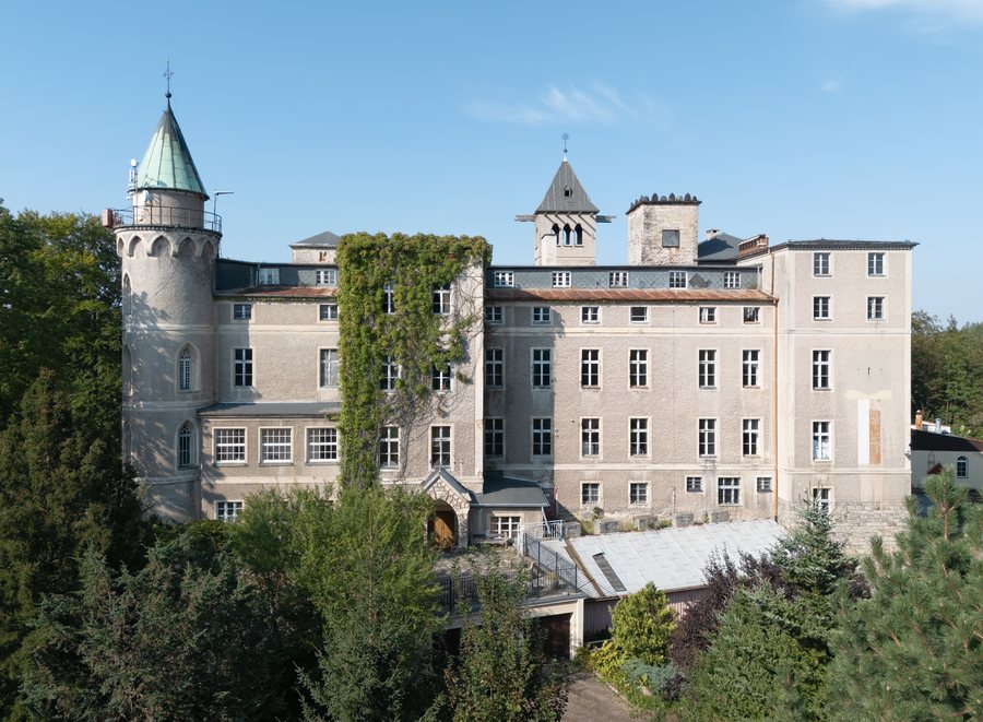
Rocky Szczytnik rises 589 metres above Szczytna. Leśna Skała, a Neo-Gothic palace built as a hunting residence between 1831 and 1838, is located there. The terrace offers wide views over the surrounding landscape. The fort on Szczytnik was built between 1790 and 1795 as part of a line of fortifications intended to warn Kłodzko Fortress of approaching enemy armies.
Hiking: climbs and longer routes
A yellow hiking trail leads from Szczytna up Szczytnik. The climb is 1.3 kilometres long and takes about 40 minutes. Its distance and estimated duration set it apart from the longer hikes.
The circular route “Ze Szczytnej na Wolarz” is 11.1 kilometres long and leads to Wolarz, which rises 852 metres above sea level in the Bystrzyckie Mountains. The starting point is a historic railway station dating from 1890. Another option is the 14.1-kilometre hike “Na Muflon.” It starts at the junction of international road 8 and Sienkiewicza Street, by the statue of St John of Nepomuk. Its destination, Schronisko pod Muflonem, is outside the municipality; most of the route runs within the municipality of Szczytna.
Cycling: a linear route and a circular ride
For a longer ride, an approximately 50-kilometre linear cycling route runs from Szczytna to Bystrzyca Kłodzka. Trains can be used for the return journey or to complete the route. If you plan to do so, check the current train service for your chosen day.
A 127-kilometre blue circular cycling route around the Stołowe Mountains also runs north of Szczytna. It follows paved roads throughout, along the Polish-Czech border. The two routes therefore differ both in length and in form: one is linear and connects two towns, while the other is a loop north of Szczytna.
Sports facilities and an event
Szczytna’s sports, active holiday and movement therapy centre has three artificial-turf playing fields and a high ropes course with a climbing wall. Another specific event is the Skatepiknik Integracyjny: held annually since 2010, it includes an Olympics for preschool children.
Discover more destinations: Lasówka, Międzylesie, Sienna, Miedzygorze, Kletno, Duszniki-Zdrój, Goworów, Jodlow
For the main travel overview: Kłodzki.

