
Auronzo di Cadore: Winter, mountains and destinations
Accommodation in Auronzo di Cadore
Winter at Monte Agudo
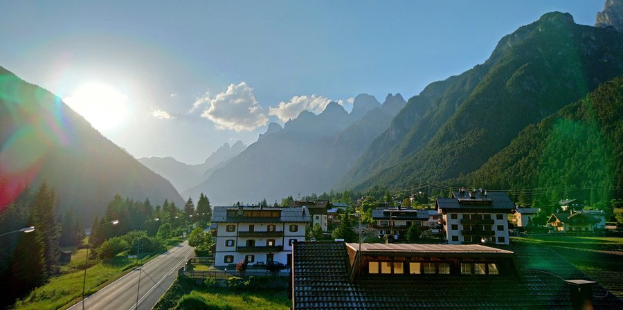
The Monte Agudo ski area in Auronzo has almost 20 kilometres of slopes and two chairlifts. The upper part of Monte Agudo is an offshoot of the Marmarole range, reaches 1,585 metres and offers views of Auronzo town centre and the Tre Cime di Lavaredo. This provides a clear basis for planning a winter trip, with specific slopes, two chairlifts and a mountain section at a clearly defined altitude as the key features.
Hiking and cycling
Trekking and summer hikes in the Marmarole massif can begin directly from Auronzo or its immediate surroundings. The 30-kilometre Auronzo–Misurina cycling and walking trail connects Lago di Santa Caterina in Auronzo with Lago di Misurina. The route is completely unpaved and has no road crossings. The approximately 15-kilometre section from Auronzo to Palùs San Marco is also suitable for families. Whether planning a longer tour or the shorter section, the surface, road crossings and distance are separate planning considerations.
Tre Cime Adventure Park
Tre Cime Adventure Park offers six courses at different heights for visitors of all ages. These include a play course for children aged 3 to 5; five other courses make up the rest of the park, with the most demanding reaching a height of 14 metres. An observation platform 20 metres above the ground offers views of the Tre Cime di Lavaredo and the Dolomites.
Lake and town centre
On Lago di Auronzo, you can explore the lake by kayak, rowing boat and pedal boat. In Auronzo town centre, historic buildings made of light-coloured stone stand beside the lake. An easy circular trail leads around these historic buildings.
Fun Bob at the mountain station
The Fun Bob track begins next to the mountain station of the Taiarezze–Malon chairlift at 1,361 metres above sea level.
Camignada poi siè refuge
The “Camignada poi siè refuge” is a traditional, non-competitive mountain race covering 30 kilometres and takes place on the first Sunday in August. The “Camignada poi siè Refuge” runs from Misurina via Rifugio Auronzo, Rifugio Lavaredo, Rifugio Locatelli, Rifugio Piani di Cengia, Val di Cengia and Val Marzon, then along the cycling trail to the finish in Auronzo di Cadore.
Tourist information point
The IAT Auronzo provides tourist information and advice on hikes and activities. The IAT Auronzo also issues fishing permits and provides information about events. For your planning, the IAT Auronzo therefore offers a specific point of contact for information about hikes, activities, fishing permits and events.
Further destinations for your planning: Corte, Colle Santa Lucia, Cencenighe Agordino, Forno di Zoldo, Vodo Cadore, Livinallongo del Col di Lana, Cortina d'Ampezzo and Pedavena.
To the higher-level travel overview: Province of Belluno.

