
Campodolcino: Winter Sports, Gorge and ViaSpluga
Accommodation in Campodolcino
The Valchiavenna Ski Area between Madesimo and Campodolcino offers more than 40 kilometres of slopes for alpine skiing. Campodolcino’s winter profile cannot be reduced to a single activity. In addition to winter sports, historic routes, gorges, high plateaus, culture and opportunities for days away from the slopes shape the character of the area.
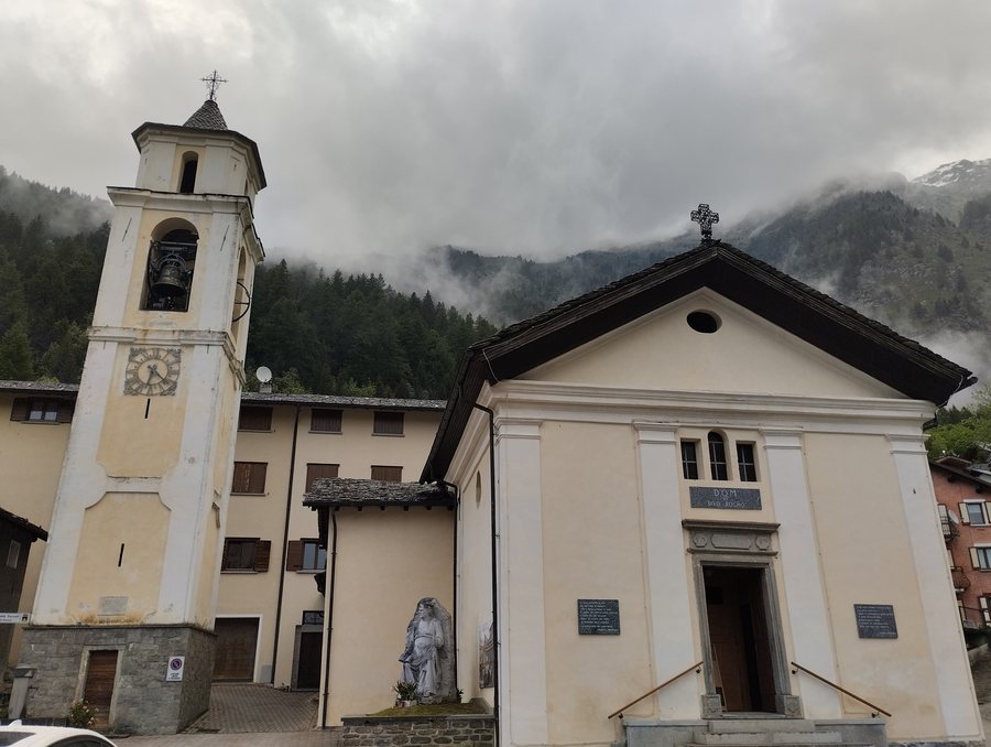 File:Campodolcino - Chiesa di San Rocco - 2023-09-05 01-02-08 001.jpg
Photo: Aniello Bizzoco via Wikimedia Commons, CC BY-SA 4.0
File:Campodolcino - Chiesa di San Rocco - 2023-09-05 01-02-08 001.jpg
Photo: Aniello Bizzoco via Wikimedia Commons, CC BY-SA 4.0
Altitude connection: Sky Express is an underground funicular railway connecting Campodolcino at 1,082 metres with the hamlet of Motta at 1,721 metres. The railway therefore leads from Campodolcino, located at 1,082 metres, to the hamlet of Motta, located at 1,721 metres.
Winter alternatives: In Campodolcino, visitors can go Nordic walking, ski mountaineering and snowshoeing in winter. These activities appeal to different ideas of a day in the snow without replacing the alpine slope offerings.
Gorge and bridge: The Caurga della Rabbiosa is a deep gorge carved by the Rabbiosa mountain stream. The Tibetan bridge at the Caurga della Rabbiosa is located there; it is 70 metres long and 45 metres high.
Historic route: The ViaSpluga passes through Campodolcino along its Italian section. The approximately 70-kilometre-long historic hiking trail connects Thusis in Switzerland with Chiavenna and follows an ancient transport route that has been used to cross the Alps since Roman times.
MUVIS: MUVIS is housed in a historic 16th-century building in the Corti district of Campodolcino. Its exhibition rooms cover traditional crafts, winter tourism, the typical home, women’s work, historic games and transport along the ViaSpluga. MUVIS is dedicated to the history and culture of a valley crossed by the ViaSpluga.
SplugaPark: SplugaPark adventure park is located in the Mottala basin of Campodolcino between the villages of Fraciscio and Gualdera. It includes Tibetan bridges, hillside paths, zip lines, ropes, nets and tree-to-tree courses.
Acqua Merla: Acqua Merla is a green park near the centre of Campodolcino with water features and opportunities for outdoor recreation. The park includes the “Serpentone”, a long water channel with curves, small tunnels and gentle slopes. The Serpentone is therefore not a straight channel, but a winding watercourse whose course is structured by small tunnels and gentle slopes.
Routes and landscape
There is also a circular route for cyclists: the “Anello ciclabile Campodolcino–Isola–Pian dei Cavalli–Campodolcino” cycling loop passes through Isola and Starleggia before returning to Campodolcino. Pian dei Cavalli is a vast high plateau with pastures, limestone rocks, caves and sinkholes.
The Angeloga Loop continues through Campodolcino and Fraciscio to Alpe Angeloga. Pian dei Cavalli is also an archaeological site where traces of Mesolithic hunter groups have been found. The closed cycling loop therefore differs from the Angeloga Loop, which continues through Campodolcino and Fraciscio to Alpe Angeloga. The landscape thus has an archaeological dimension in addition to its geological one.
Oga, Pedenosso Valdidentro, Chiesa In Valmalenco, San Carlo, Bormio, Torre Di Santa Maria, Santa Caterina Valfurva, Montespluga.

