
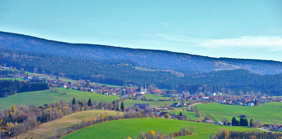
Hinterschmiding
Accommodation in Hinterschmiding
For your winter plans, the location of the Mühlberglift is important: it is in Herzogsreut, within the municipality, directly on the B 12. Operating hours depend on the season; check in advance whether the lift will be open on your travel dates.
Circular Trails Starting in Hinterschmiding
The Am Biegel circular trail starts at the tourist information office and runs via the village square, past the listed town hall and around the Biegel. Along the way, you also pass the wildlife enclosure and the land consolidation memorial stone. At 3.3 kilometres long with 80 metres of elevation gain, the route offers concrete figures to help with planning. Its various stops connect the village centre and surrounding area in a circular route.
At nine kilometres, the Möselweg is longer. You can start at Hinterschmiding’s church square or at the parking bay by Möselstadion. The route is listed as taking about two and a half hours to walk, with around 230 metres of elevation gain. Compared directly with the Am Biegel circular trail, it is not only longer but also has a greater elevation difference. Those who want to plan their day around a stated walking time will find one for the Möselweg; the Am Biegel circular trail is described by its distance and elevation gain, which provide concrete comparison figures.
Nordic Walking and Routes of Varying Lengths
The municipality of Hinterschmiding offers five Nordic walking routes totalling about 33 kilometres. Individual circuits have different features. The 6.4-kilometre Biegel Trail starts at the Biegel, by the land consolidation stone, follows field and forest tracks along the route of the Golden Trail, and returns to the starting point.
The red-marked Holzwiesen Trail runs from Möselstadion via the Holzwiese and back to the stadium. It is 7.5 kilometres long and has 80 metres of elevation gain. Check the local trail markers before relying on them in the field. Another option is the 5.5-kilometre Kohlstatt Trail from Möselstadion: the route passes the Kohlstatt Chapel and a viewpoint near Sonndorf before returning to the sports ground. This lets you compare the circuits by distance, elevation gain and the waypoints listed for each, without assuming a walking time.
Circular Trails in Herzogsreut
There are also marked trails starting in Herzogsreut, within the municipality. The Zum Bäckerkreuz circular trail starts in the village centre near the old sports ground. It follows the main road to the exit towards Hinterschmiding, then Ringstraße to the Bäckerkreuz and returns via the upper station at the ski lift. The circuit is two kilometres long, with 50 metres of elevation gain.
Other Nordic walking circuits in Herzogsreut differ in their markings and lengths. The red-marked trail starts after the church on Schwendreuter Straße, passes the Schwendreut Chapel, the Bruder-Konrad Chapel and the Bäckerkreuz, then returns to Herzogsreut. It is about 6.9 kilometres long with 100 metres of elevation gain. The black-marked Herzogsreuter circuit starts near the old sports ground in the village centre, follows field and forest tracks back to the starting point and is 6.3 kilometres long; its elevation difference is 90 metres. Both descriptions refer to trails in Herzogsreut within the municipality.
History in the Village and the Wider Destination
The Wimmerkanal is located near Hinterschmiding. Built in 1806, it was once used for timber rafting; today, it is an important technical monument from the early 19th century. A section of the Golden Trail runs through the municipality of Hinterschmiding. These historical connections add insights into past uses and regional history to the area’s network of trails.
The wider destination of Freyung-Grafenau also includes the Bavarian Forest National Park, which extends into the district. It opened on 7 October 1970 as Germany’s first national park. The 2024 zoning map designates 75.37 percent of the national park area as natural zones. Another distinct landscape within the wider destination is Buchberger Leite: there, steep rock barriers force the rubble- and cascade-rich Wolfsteiner Ohe into a deeply constricted bed; remnants of primeval forest have survived in the moss- and fern-rich gorge forests. An eight-kilometre themed hiking trail with information boards and an accompanying brochure runs through the gorge between Freyung and Ringelai.
Discover more destinations: Schöfweg, Grainet, Mauth, Schönberg, Spiegelau, Sankt Oswald-Riedlhütte, Hohenau, Innernzell
Back to the wider travel overview: Freyung-Grafenau.

