
Oberdachstetten: Trails, Nature and Local History
Accommodation in Oberdachstetten
Oberdachstetten lies in the upper reaches of the Rezat in a high-altitude area rich in woodland; the municipal area is part of the Frankenhöhe Nature Park. Visitors can choose from a range of activities: circular hiking trails with published distances and difficulty ratings, churches and historical sites, cycling routes, and a bathing area run by the municipality. Plan your stay according to whether you would rather hike, cycle, explore local history or experience the church festival.
Compare hiking trails by length and difficulty
The circular trails vary in length and rating; the “Storch” trail also lists its elevation gain. This makes it easy to compare the routes based on their published characteristics:
- The “Storch” circular trail runs from Oberdachstetten to Urphertshofen and back. It is 6.7 km long, has 160 metres of elevation gain and is rated moderate.
- The “Rote Milan” is 7.4 km long and rated moderate. The route passes Waldeslust, Spinnerin, the burial mound, the Rezat spring and the quarry before returning via Waldeslust to Oberdachstetten.
- The moderately difficult “Eichblatt” circular trail is 9.5 km long and runs via Buchenberg, the hunting lodge and Spielberg back to Oberdachstetten.
- The “Bachstelze” runs via Spielberg, the B 13 south of Hohenau and Mitteldachstetten before returning to Oberdachstetten. This moderately difficult circular trail is 13.8 km long.
- The “Steinpilz” starts and ends in Anfelden, passes Landsknecht and the Schwedenkreuz, and is 7.2 km long. It is rated easy.
Of these five circular trails, the “Storch” is the shortest and the “Bachstelze” the longest. The “Steinpilz” is the only trail rated easy; the other four are rated moderate. These distinctions can help you choose based on trail length and the stated difficulty rating.
Springs, Trails and Nature
The Rezat spring is in the municipal area, on the hiking trail from Oberdachstetten to Marktbergel. The European Watershed Trail offers a way to explore the municipal area on foot. The Teufelsgraben is a sight along the hiking trail from Oberdachstetten to Westheim. The so-called “Spinnerin” is also on this trail; a grave monument in the shape of a Romanesque cross commemorates her.
Part of the “Weiherboden bei Anfelden” nature reserve includes important wetland habitats for specific animal and plant species, which are maintained through extensive farming. Together with its location in the Frankenhöhe Nature Park, this gives nature and landscape a prominent place in local visitor information.
Churches with Different Architectural Histories
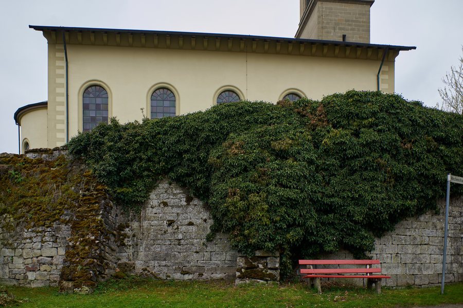
St. Bartholomew’s Church in Oberdachstetten was built between 1837 and 1844 in the Munich Neoclassical style. The church in Berglein has a different character: it is a fortified church, and remnants of medieval masonry have been preserved in its choir tower and adjoining sacristy.
The church in Mitteldachstetten was first mentioned in a document in 1122. Its choir tower was built in the late 14th century and has loopholes. The three churches thus represent different aspects of local history: Neoclassical architecture, a fortified church with preserved masonry, and a medieval choir tower.
Bathing Area and Church Festival
The municipality-run bathing area offers a chance to cool off in the water, a sunbathing lawn and a volleyball court; sanitary facilities are available. There is also a youth campsite with an operations building and bathing area on the outskirts of Oberdachstetten. If you are considering staying at this site, check booking options and current availability in advance.
The church festival in Oberdachstetten takes place every year on the third Sunday in October. The traditional parade ends with the “Pariser Eilrad.” If you would like to plan your stay around the event, also check the specific arrangements for the date in question.
Getting Here and Cycling Routes
Oberdachstetten railway station can serve as a starting point for many day trips and for travel to and from Nuremberg and Würzburg. Check the current timetable for your specific journey.
There are also several route options for cyclists: the Bibert Valley Cycle Path passes through Oberdachstetten and can be linked in Romantic Franconia with the Castle Road Cycle Route and the Zenn Valley Cycle Path. The Aisch Valley Cycle Path, which comes from Bamberg, passes through the municipal area. When planning your accommodation, you can consider these cycling routes alongside the hiking trails and local attractions as additional options.
Discover more destinations: Neuendettelsau, Wilburgstetten, Rothenburg Ob Der Tauber, Wassertrüdingen, Wolframs-Eschenbach, Langfurth, Merkendorf, Adelshofen.
For the main travel overview: Ansbach.

