
Neuberg: Hotels and accommodations
Accommodation in Neuberg
Podhradí is located in the Aš salient, in the valley of the Ašský potok toward the border with neighboring Germany, at an elevation of 562 m. The surrounding landscape also includes the ruins of Neuberg Castle: they lie 3.5 km north-northeast of Aš on a rock above the left bank of the Ašský potok.
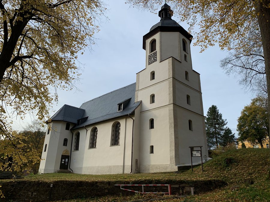 File:Kostel Dobrého pastýře v Podhradí u Aše JV.jpg
Photo: Jan2jen via Wikimedia Commons, CC BY-SA 4.0
File:Kostel Dobrého pastýře v Podhradí u Aše JV.jpg
Photo: Jan2jen via Wikimedia Commons, CC BY-SA 4.0
Landscape and surroundings
Brunnenberg is a mountain in the immediate vicinity of Podhradí. The surrounding area also includes Pfaffenberg, Rabenberg, and Galgenberg; all three are considered mountains in the vicinity of Podhradí.
The wider regional surroundings also include the Erika Fuchs House Museum for Comic Art and Language, a museum, Waldstein, a ruin, as well as the Stadtpark, a park. The Church of St. Michaelis in Bad Brambach is also located in the vicinity of Podhradí.
Castles and history
Neuberg Castle was built around the beginning of the 13th century. After a major fire in 1610, the castle in Podhradí no longer served as the main center of the Zedwitz lordship in the Asch region. Of the Upper Castle, only the front section of the wall and the windows remain. The original feeding troughs have been preserved in the former stable of the Upper Castle.
Church and culture
The Church of the Good Shepherd is a protected cultural monument. Its altar, created by M. Zeitler, dates from 1710.
Route through the surrounding area
The Green Route 1.0 leads from Podhradí via mineral springs to Hazlov.
To the higher-level travel overview: Eger District.
More destinations
Other places under the same destination:

