
Panske Pole: Hotels and Accommodation
Accommodation in Panske Pole
You can also join the Jirásek Mountain Trail in Panské Pole. The section from Mezivrší via Panské Pole (Hanička) to Rokytnice is 12 km long.
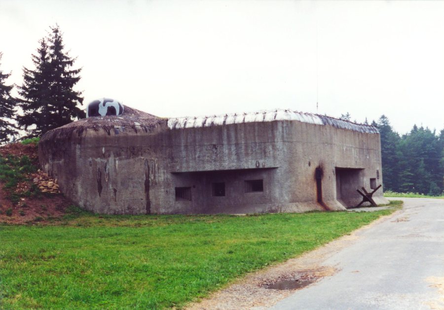 File:Rokytnice v Orlických horách, Panské Pole, R-S 74 (rok 2000).jpg
Photo: User:Harold 's family via Source, CC BY-SA 3.0
File:Rokytnice v Orlických horách, Panské Pole, R-S 74 (rok 2000).jpg
Photo: User:Harold 's family via Source, CC BY-SA 3.0
History
The Rokytnice Fortifications Educational Trail leads to structures of the Czechoslovak fortifications built on the ridges of the Orlické Mountains between 1936 and 1938. It comprises fourteen information panels and follows the red hiking trail markings between Panské Pole and Anenský vrch.
The Hanička Artillery Fortress was built between 1936 and 1938 as part of Czechoslovakia's border defence. The Panské Pole cadastral area is also home to structure R-S-74, an infantry block of the heavy fortifications listed as a cultural monument.
Trails and Viewpoints
The ANNA observation tower stands on Anenský vrch at an elevation of 991 m above sea level and is almost 17 m high. The observation tower offers views in all directions and is freely accessible.
Landscape
The Hanička Museum is best reached via the red hiking trail along the ridge of the Orlické Mountains. Above the Panské Pole–Hanička settlement, a branch from this trail leads directly to the museum grounds. The access route from the designated parking area to Hanička Fortress follows the red hiking trail towards Anenský vrch through the Orlické hory Protected Landscape Area.
When visiting Hanička Fortress, you will see the museum and pass through underground passages beneath the individual fortification structures.
Other places: Bartosovice V Orlickych Horach, Javornice, Podbřezí, Ohnišov, Sediviny, Bystré, Rícky V Orlických Horách, Dobré
To the higher-level travel overview: Rychnov nad Kněžnou District.

.jpg)