
Villanders between the village center, Archeoparc and Villanderer Alm
Accommodation in Villanders
Villanders and the Villanderer Alm
The Villanderer Alm is an extensive high alpine pasture above Villanders, between the Tinnebach and Zargenbach streams. Lush green meadows, moors, lakes and grass-covered mountain peaks characterize the landscape. This means that, alongside the village itself, a clearly defined natural area is also at the heart of the experience, with its individual landscape features easy to incorporate into an excursion plan. Numerous mountain huts on the Villanderer Alm offer hikers traditional dishes and refreshing drinks. A break at one of the mountain huts can be planned as a separate part of the day. Bus route 345 connects Klausen, Villanders and the Villanderer Alm.
Hiking with specific route details
A designated hike is named “Villanders–Flor–Dreikirchen–Villanders”. It follows trails 4, 10 and 11, is 10 kilometers long, and has 638 meters of elevation gain and 640 meters of elevation loss. The complete details also make the tour appealing to guests who plan their day not only around a destination but also around distance and elevation differences. The separate ascent and descent figures can help estimate the physical demands of the loop for your own day plan. The hike, as its name suggests, leads from Villanders via Flor and Dreikirchen back to Villanders. When preparing for the loop, you can incorporate the ten kilometers as well as the ascent and descent separately into your day plan.
Archaeological traces on the Plunacker
The Archeoparc Villanders is an archaeological site on the Plunacker. The site contains remains from the Stone Age, Copper Age, Bronze Age and Roman period. Archaeological settlement traces and burial sites at the Archeoparc Villanders show that people lived there more than 7,000 years ago. The Archeoparc Villanders also features reconstructed buildings, including a Mesolithic dwelling, a Neolithic hut and a Raetian house. Here, you will encounter both original archaeological traces and vivid reconstructions from different periods.
Village center, church and cemetery
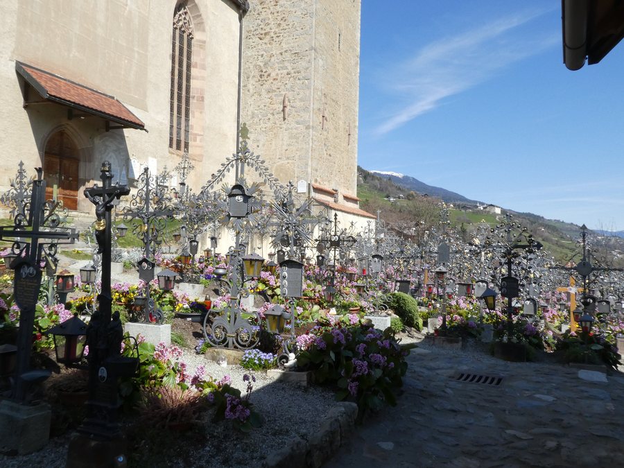
The old village center of Villanders, its narrow lanes and the two soaring Gothic towers served Franz von Defregger as the backdrop for his painting “The Last Levy”. The Church of St. Michael at the cemetery in Villanders was consecrated in 1344. In the cemetery by the Church of St. Michael in Villanders, the front sides of the exclusively wrought-iron grave crosses are positioned facing away from the burial mound. The village center, church and cemetery therefore form several independent points of interest for a tour through the local architectural and commemorative culture.
Mining history in the Tinne Valley
In the mining complex in the Tinne Valley, 16 adits with a total length of 25 kilometers were excavated.
Other places in the Isarco Valley
Other destinations in the same broader area include Mühlbach, Meransen, Brixen, Villnöß, Klausen, Rodeneck, Lajen and Lüsen.
For the broader travel overview: Isarco Valley.

