
Lüsen: Panorama, Cross-Country Skiing and Children's Area
Accommodation in Lüsen
Alpine Pasture Area, Elevation and Panorama
The Lüsen Alpine Pasture covers 23 km² and lies at an elevation of 1,800 to 2,400 metres. It extends for 20 kilometres from Zumis to the Maurerberg and includes more than 80 individual alpine pastures. From the Lüsen Alpine Pasture, the panorama stretches from the Peitlerkofel to the Zillertal Alps. The Peitlerkofel is 2,875 metres high and is regarded as Lüsen's landmark. For hikers, the elevation and extent are concrete factors for planning a day's excursion on the alpine pasture. The landscape gains an additional clear point of reference through the Peitlerkofel. The range of elevations and the size of the alpine pasture give the landscape a spacious alpine setting.
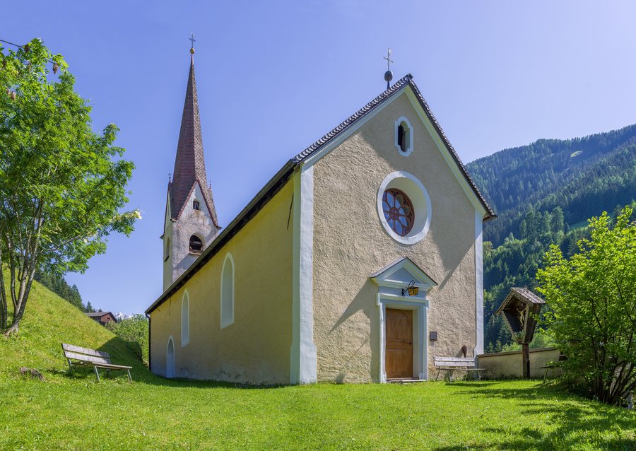 File:St. Nikolaus in Petschied Kirche Fassade Lüsen Südtirol.jpg
Photo: Photo: This Photo was taken by Wolfgang Moroder . Feel free to use my photos, but please mention me as the author and send me a message . This image is not in the public domain . Please respect the copyright protection. It may only be used according to th
File:St. Nikolaus in Petschied Kirche Fassade Lüsen Südtirol.jpg
Photo: Photo: This Photo was taken by Wolfgang Moroder . Feel free to use my photos, but please mention me as the author and send me a message . This image is not in the public domain . Please respect the copyright protection. It may only be used according to th
Hiking Routes across the Alpine Pastures
The hike to the Kreuzwiesen Alm leads from Oberflitt across the Lüsen Alpine Pasture. There is an opportunity to stop for refreshments at the Kreuzwiesen Alm. Those planning their first hike can include this stop at the destination. Another hiking route passes the Astalm and leads to the Campill summit, which is also called Hörschwanger Kreuz. After the summit, the route descends to the Kreuzwiesen Alm. The return route to Lüsen leads via the Schmalzhaussteig, Flitt and Rungg.
Cross-Country Skiing and Children's Area
The high-altitude cross-country ski trail network on the Lüsen and Rodeneck Alpine Pastures covers more than 20 kilometres. For cross-country skiing enthusiasts, this network length is a concrete planning figure; the term high-altitude cross-country ski trail refers to cross-country skiing at a higher elevation. On a cross-country skiing tour, the network length can serve as an indication of scale without specifying a particular loop distance. The “Rungg” lift in Lüsen has a children's area. Winter sports therefore include the trail network on two alpine pastures and the children's area at the “Rungg” lift in Lüsen.
Alpine Pasture Products and History
When visiting the Kreuzwiesen Alm, visitors can watch the cheese-making process and then taste fresh mountain cheese directly from the producer. The Stricker Mill in Lüsen has historical roots dating back to 1645. The mill is located in Lüsen itself, while the cheese production is tied to the Kreuzwiesen Alm. The alpine pasture and the mill therefore focus on different aspects, between traditional craftsmanship and local history.
Getting There and E-Carsharing
When travelling to Lüsen by car, the Bressanone/Varna motorway exit is recommended. Via the bypass, access to Lüsen is reached through the town of Brixen. Those arriving by car can plan this sequence for the approach. An E-Carsharing service from AlpsGo is available in the municipality of Lüsen. Car access and E-Carsharing therefore concern different stages of mobility around Lüsen.
Route from Lüsen Village
The route starts in Lüsen Village. It leads to the Nikolauskirchl in Petschied. The return journey goes via the Stations of the Cross, the Old Crafts Zone and the bathing pond to Lüsen Village.
Other places: Natz-Schabs, Barbian, Villnöß, Mühlbach, Rodeneck, Villanders, Lajen, Klausen
To the overarching travel overview: Eisack Valley.
