
Discover Camandona: Trails, Sanctuaries and Mountain Landscape
Accommodation in Camandona
Landscape of the Biella Prealps
Camandona lies in the Biella Prealps and extends along the slopes of Rocca d’Argimonia. The municipality lies between 562 and 824 m above sea level. This means that different elevations can be encountered within a small geographical area, while Rocca d’Argimonia forms the landscape setting.
Camandona consists of 16 scattered hamlets. The hamlets lie on ridges and in small valleys. For the most part, they are hidden by lush vegetation: chestnut trees and mighty beech trees grow in the landscape, while birches are also found at higher elevations. Ferns and heather complete the picture of the vegetation-covered slopes.
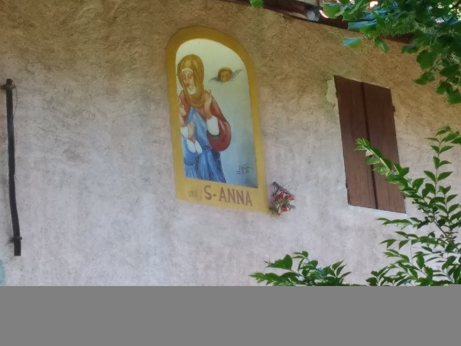 File:Camandona Cascina Bunda Granda - dipinto S.Anna.jpg
Photo: Lucapassu via Wikimedia Commons, CC BY-SA 4.0
File:Camandona Cascina Bunda Granda - dipinto S.Anna.jpg
Photo: Lucapassu via Wikimedia Commons, CC BY-SA 4.0
Scattered hamlets and green slopes
Hiking trails along old routes
Hiking trails run along old mule tracks and connect the hamlets of Camandona. The routes thus reflect a historic form of travel and lead through a place whose settlement structure consists of many individual hamlets.
Churches, palazzi and frescoes
The parish church was built around 1530. Palazzo Sogno was built in 1776 by Stefano Basso and is reminiscent in style and structure of French Provençal “manoirs”. The hamlets of D’Agostino, Cerale and Guelpa are typical examples of 18th-century terraced houses.
There are around 30 frescoes in Camandona, most of which are votive paintings from the second half of the 19th century. Along the roads, mule tracks and paths connecting Camandona’s hamlets with the mountain pastures, there are more than 20 votive chapels. The frescoes and chapels thus complement the historic buildings with another form of religious imagery.
Santuario del Mazzucco and I sentieri della Fede
Santuario del Mazzucco was built in the first half of the 17th century on the ruins of an older chapel and is dedicated to Sant’Anna. Santuario del Mazzucco is an oratory in a scenic location, surrounded by centuries-old beech forests. The “I sentieri della Fede” trail is connected to Santuario del Mazzucco and links the sanctuary with the sanctuaries of Banchette and della Brughiera.
Mazzucco picnic area
The Mazzucco picnic area lies at an altitude of 900 m in a beautiful location immediately below and beside the Santuario del Mazzucco of the same name. The Mazzucco picnic area has tables, barbecue facilities, play equipment for children and toilets.
Diga di Camandona and artificial lake
The Diga di Camandona was built in the middle of the 20th century. The Diga di Camandona ensures a regular water supply for the numerous textile businesses located downstream in the valley. The Diga di Camandona created an artificial lake that is a popular destination for anglers.
Transhumance road and living tradition
The transhumance road is still used today by shepherds who continue this millennia-old tradition. In recent years, the transhumance road has been enhanced with ethnographic information panels. In this way, the historic use of the road is combined with explanations of traditional pastoral farming.
“Anello di Carcheggio” walk
The “Anello di Carcheggio” walk begins at Santuario del Mazzucco. From Callabiana, the sanctuary can be reached after passing by the Diga di Camandona and passing through the hamlets of Gallo and Mino di Camandona. The walk and this described connection therefore refer to different starting points and sections of the route around the sanctuary.
Further destinations: Romagnano, Campiglia Cervo, Pollone, Muzzano, Netro, Graglia, Solesio, Bioglio
For the overarching travel overview: Province of Biella.

