
Muzzano: Landscape, Hiking Trails and Local History
Accommodation in Muzzano
Location on the Elvo and Rural Landscape
Muzzano lies on the right bank of the Elvo River. Near Muzzano, the Elvo Valley features a wooded narrow section with a small canyon. Muzzano’s rural landscape has been preserved over time through human labor. The farmsteads around Monte Cuchello particularly clearly express Muzzano’s rural surroundings.
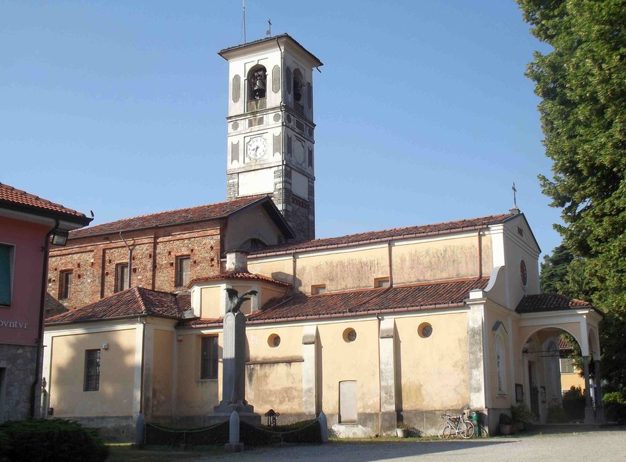 File:Vista laterale di Sant'Eusebio, chiesa parrocchiale di Muzzano, Italia.jpg
Photo: F Ceragioli via Wikimedia Commons, CC BY-SA 4.0
File:Vista laterale di Sant'Eusebio, chiesa parrocchiale di Muzzano, Italia.jpg
Photo: F Ceragioli via Wikimedia Commons, CC BY-SA 4.0
Bagneri: Mountain Hamlet and Historical Traces
Bagneri is a mountain hamlet within Muzzano, at an elevation of around 900 meters. Bagneri can be reached via the SP511 between Muzzano and the Santuario di Graglia; the final ten minutes of both routes are completed on foot. In the 19th century, Bagneri and the nearby Salvine area had between 300 and 400 inhabitants. Events organized by the community in Bagneri include an autumn Castagnata.
Confraternita del Rosario and Exhibitions
The church of the Confraternita del Rosario was built between 1606 and 1619. The Madonna del Rosario continues to be carried in procession at the Confraternita del Rosario on the first Sunday in October. A 17th-century fresco in the Confraternita del Rosario depicts the Santuario di Oropa and bears the year 1632.
The exhibition “Antonio Bertola ingegnere militare” is housed in the town hall opposite the Confraternita del Rosario. The exhibition “Antonio Bertola ingegnere militare” relates the figure of Antonio Bertola to the local landscape and to historical and religious paths and routes. The Ecomuseo della Civiltà Montanara di Bagneri is located in Bagneri, Muzzano. The ecomuseum section in Bagneri includes an old carpentry workshop, the old schoolroom, a chestnut room and a hut for drying chestnuts.
Hikes and Routes
An easy hike leads from Muzzano to Bagneri, taking in nature, geology, history and local legends. The most frequently used route, C31, starts at the car park above Bagneri, at an elevation of around 970 meters. Route C31 follows a gravel road open only to authorized users, reaching the mountain huts in the municipality of Muzzano at an elevation of over 1,250 meters.
A short circular trail connects Muzzano and Graglia and leads around the wooded Monte Cuchello. The circular trail around the wooded Monte Cuchello offers views of Biella, Mombarone and the Serra. A route from Oropa or San Carlo via the Tracciolino reaches the Salvine alpine pastures and ends about 100 meters above the church. Historically, and in part still today, an irrigation canal supplied fields and gardens in Graglia and Muzzano with water.
Other places for orientation: Caprile, Romagnano, Graglia, Pollone, Biella, Netro, Campiglia Cervo, Sordevolo.
For the main travel overview: Province of Biella.

