
Champdepraz – Mont Avic Nature Park and Mining History
Accommodation in Champdepraz
Champdepraz and Mont Avic Nature Park
Mont Avic Nature Park protects the upper catchment area of the Torrente Chalamy in the municipality of Champdepraz. A catchment area is the area from which water drains into a body of water. Extensive sequences of green rocks occur in the Champdepraz area, particularly peridotites, eclogitic metagabbros and eclogitic-glaucophanitic metabasalts. The numerous wetlands in Mont Avic Nature Park are considered the most important biotopes in the protected area.
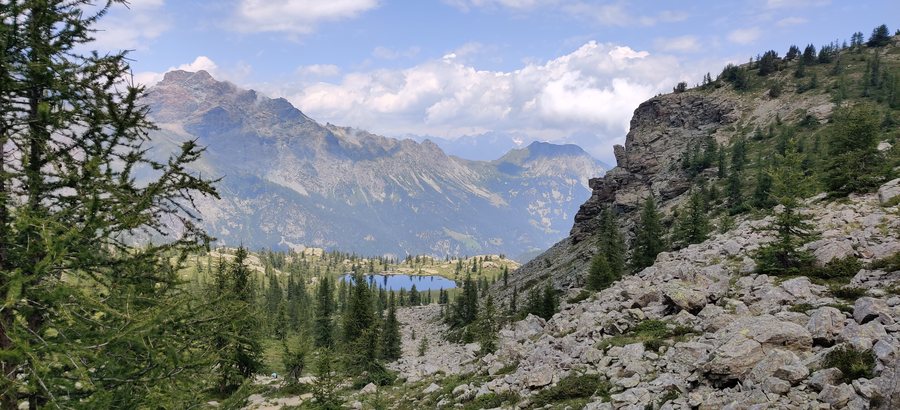
Hiking through the park
Hiking is possible on the trail network of Mont Avic Nature Park in every season. From November to May, many trails are usually largely covered in snow and can only be used by experienced people with suitable equipment. If you hike between November and May, take the snowy trail conditions into account when choosing your route.
Trails, villages and views
A hiking trail in Mont Avic Nature Park passes through various types of forest to the rural villages of Boden and Gettaz des Allemands, across the meadows of Pana and to the lake of the same name. The features of this trail include geomorphological phenomena, rural architecture, forest birds, and the flora and fauna of the wetlands. There are also views of Monte Rosa and the Matterhorn.
Nighttime trail near Veulla
The rural road from Veulla to Pont de Leser can be used after sunset with a portable lamp and an audio guide. Fifteen stopping points, identifiable by reflective markers, provide a special nighttime perspective of the protected area.
Giroparchi from Chevrère
The main route of the Giroparchi trail network connects Mont Avic Nature Park with Gran Paradiso National Park. One starting point is in Chevrère di Champdepraz at the Covarey visitor center.
Hérin and the traces of mining
The visible traces of the mining history include the remains of the Hérin copper mine, located outside the protected area along Trail No. 8. These include buildings, inaccessible tunnel entrances, a large spoil heap and several cableway supports. The iron-copper mineralizations of Hérin lie above the main settlement of Champdepraz and outside the park; they were intensively mined in the 18th century and intermittently until 1951.
Further remains in Champdepraz
The Lac Gelé mine is also visible in Champdepraz along Trail No. 6; it includes the tunnel entrances and the spoil heaps from the mining activity. The ruin of the Servaz blast furnace preserves structural details that make it possible to understand how it functioned. At the Barma de Rova millstone quarry, several millstones that have only been roughly worked are visible on the rock face.
Val Chalamy and rural construction
Numerous charcoal-burning sites are visible in the forests of Val Chalamy along Trails 3, 5c and 7a. The rural buildings in Champdepraz were built from stone and wood obtained locally.
Further destinations: Saint Jacques, Gressan, Bionaz, Breuil-Cervinia, Lillianes, Doues, Rhêmes-Notre-Dame, Pontboset
To the overarching travel overview: Aosta Valley.

