
Saint Jacques in Val d’Ayas: Trails, Mountain Views and Culture
Accommodation in Saint Jacques
Saint-Jacques among Meadows, Forests and History
Saint-Jacques is a small village among meadows and forests. As one of the historic villages of Val d'Ayas, Saint-Jacques forms part of a shared historical, architectural and landscape heritage of exceptional value. The culturally and historically significant complex of the Chiesa vicariale di Saint-Jacques dates from the 18th century and is already mentioned in 1227. The Cappella di San Giacomo is accessible from the main road via steps.
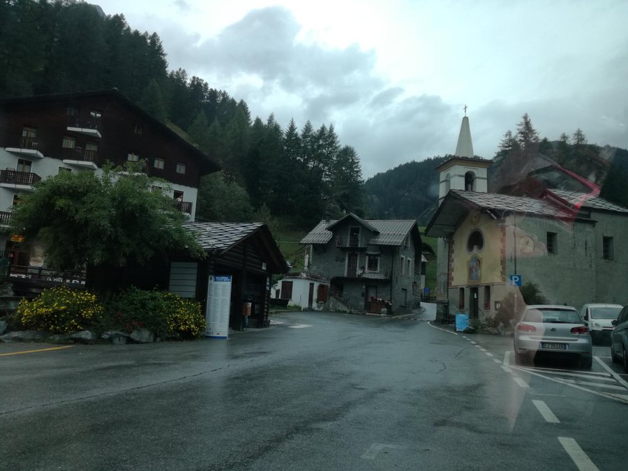 File:Place de la Grotte - Saint-Jacques-des-Allemands (Ayas).jpg
Photo: Capricornis crispus via Wikimedia Commons, CC BY-SA 4.0
File:Place de la Grotte - Saint-Jacques-des-Allemands (Ayas).jpg
Photo: Capricornis crispus via Wikimedia Commons, CC BY-SA 4.0
Ayas and the “Verrès – Saint-Jacques” Bus Route
Ayas can be reached by the “Verrès – Saint-Jacques” bus route.
Lago Blu: Starting Point, Elevation Gain, Trail No. 7 and Monte Rosa
The hike to Lago Blu begins in Saint-Jacques at an altitude of 1,689 metres, gains 550 metres in elevation and takes just under two hours. The route follows Trail No. 7 via Fiéry and the lower Plan di Veraz. The walking time of just under two hours, together with the 550-metre elevation gain, can be factored into a day of hiking. At the destination, Lago Blu has intensely turquoise-coloured water; the Monte Rosa massif lies in the background.
Further Trails via Plan di Veraz and Fiéry and to Rifugio Ferraro
The route from Saint-Jacques to the Rifugio Mezzalama mountain hut also follows Trail No. 7 through the Plan di Veraz area and leads to the hut across a glacier moraine. The Anello Ferraro / Verra circular route begins in Saint-Jacques and leads through Fiéry and the Piani di Verra. Another hike to Colle della Bettaforca begins near the village church and follows Trail No. 9 towards Résy and Rifugio Ferraro.
High-Altitude Trails to Cime Bianche and the Piani di Verra
The route from Saint-Jacques to Colle Superiore delle Cime Bianche forms part of the Tour del Monte Rosa and reaches the pass in around four hours, with approximately 1,293 metres of elevation gain. For the route to Colle Superiore delle Cime Bianche, the approximately 1,293-metre elevation difference should be taken into account when planning the day. The route from Saint-Jacques to the Piani di Verra takes around three hours and has an elevation gain of approximately 364 metres to the lower plateau and approximately 693 metres to the upper plateau. At around three hours, the route to the Piani di Verra is shorter than the approximately four-hour route to Colle Superiore delle Cime Bianche.
Panoramic Views at Colle della Bettaforca and on the Sentiero Frassati
The Piani di Verra offer expansive yet close-up views of Monte Rosa. At Colle della Bettaforca, there are views of the Ayas and Gressoney valleys. The Sentiero Frassati offers views of the Walser village of Resy.
Further places to include in your travel planning are Bard, Gignod, Gressoney-Saint-Jean, Villeneuve, Ayas, Ollomont, Roisan and Champdepraz.
For the overarching travel overview: Aosta Valley.

.jpg)