
Kirchwald: Panorama Trail, Floodplain Meadows and St. Dionysius Parish Church
Accommodation in Kirchwald
Get to know Kirchwald through its landscape and specific points of interest: the Panorama hiking trail leads to sweeping views, past Mohrsberg and to the Nitzblick viewpoint. Wetlands, a stream and ponds define the natural setting of the Kirchwald Floodplain Meadows. Other highlights include St. Dionysius Parish Church, the small shrine on Mohrsberg and events throughout the year. These varied themes can help you decide whether to focus on views, nature or local culture during your stay.
Panorama Trail: Long-Distance Views and Notable Waypoints
The Panorama Trail starts and ends at the village square. It is signposted with directional arrows, distance markers and location boards. There is a car park at the village square next to St. Dionysius Parish Church; check local parking conditions before setting off. The trail offers unobstructed views across the Eifel countryside for almost its entire length. On a clear day, you can see as far as the Hunsrück, Westerwald and Taunus. The Panorama Trail also offers sweeping views across the Nitz Valley to Hohe Acht.
The Nitzblick viewpoint is a particular highlight along the Panorama Trail. To reach it, take Zum Nitzblick road, a paved path past the barbecue hut, then follow a forest path for about 100 m. The Panorama Trail also passes Mohrsberg. Its upper southern slope is characterized by dense juniper growth, partly overgrown with scrub. The route thus combines expansive views with a distinctive vegetation-covered slope.
Kirchwald Floodplain Meadows: Wetland and Nature Trail
The protected area known as the “Kirchwald Floodplain Meadows” includes a wetland with three ponds arranged one after another. Its diverse wildlife includes a rich variety of insects and numerous birds. The “Kirchwald Floodplain Meadows” nature trail is a walking path about 1.3 km long. It follows a stream through woodland and a landscape of ponds, crossing three bridges. The stream, woodland, ponds and bridges together shape the route.
Free guided tours of the nature trail are available for groups of five or more; donations are welcome. If you plan to join a tour, check that it will go ahead before you travel.
Church and Wayside Shrine
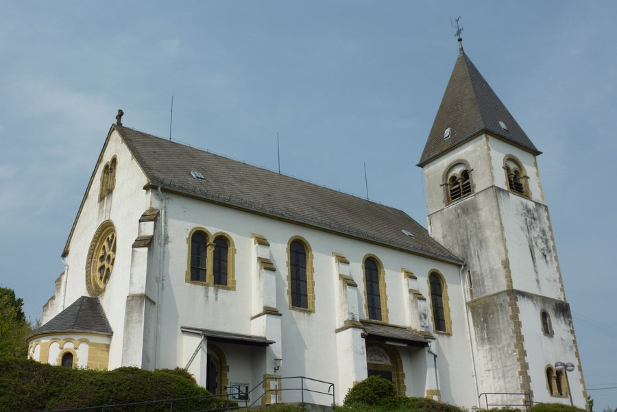
The present-day St. Dionysius Parish Church in Kirchwald was built in 1906/1907 and consecrated in 1908. At the foot of Mohrsberg, a small wayside shrine stands beside the Panorama Trail, dedicated to Saint Roch and the Virgin Mary. It offers a welcome opportunity to rest. The church and the shrine provide different points of interest: the parish church offers a tangible glimpse into the village’s architectural history, while the small shrine is also a waypoint on the Panorama Trail.
Events and Cycling
Various events and festivals take place in Kirchwald throughout the year. If you plan to travel for a particular festival, check the date in advance for your travel period. Cyclists can use a “Stopp-o-Mat” measuring station in Kirchwald. If you want to plan your visit around taking a measurement there, check whether it is currently operating. This makes it easy to factor event dates and use of the measuring station into your plans.
Discover more destinations: Boos, Nitztal, Siebenbach, Vordereifel, Acht, Baar, Welschenbach, Ettringen.
Back to the main travel overview: Mayen-Koblenz.

