
Lenggries: Cross-Country Skiing, Cycling Routes and Culture
Accommodation in Lenggries
Lenggries offers a clear focus on cross-country skiing during your stay: the local area has 42 kilometres of groomed trails. Cycling loops, natural attractions and cultural stops round out the picture. When planning, you can therefore decide whether you want to spend most of your time on the trails, cycling, or exploring local and regional history.
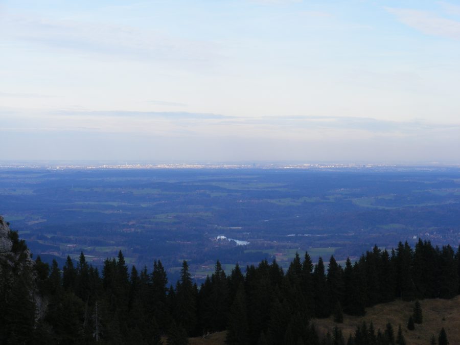 Blick vom Brauneck bei Lenggries nach Norden; am Horizont ist München zu sehen.
Photo: User:Mattes via Wikimedia Commons, CC BY-SA 3.0
Cross-Country Skiing and Winter Planning
The 42 kilometres of trails refer to the local area of Lenggries. In addition, a 1.5-kilometre floodlit night trail runs north of the Brauneck mountain station as far as the Gilgenhöfe. These figures describe different scopes: the total trail kilometres in the local area, on the one hand, and a single, specifically identified night trail, on the other. When planning your days, it is therefore worth checking which route and area might suit your outing. Grooming and conditions can change; check the latest information before setting out.
Cycling Routes and Destinations in the Isar Valley
Another specific option is the easy cycling loop from Lenggries via Wegscheid to Leger. It is 13 kilometres long, takes about an hour, and starts and ends at the Isar Bridge in Lenggries. Along the way, it follows the Isar and Jachen rivers through idyllic floodplain meadows. The distance and approximate duration give you an idea of the time required; starting and ending at the same bridge also makes clear where the loop begins in Lenggries. You can compare these details with the cross-country skiing options when planning, without treating the different activities as equivalent.
The Sylvensteinsee lies about 15 kilometres south of Lenggries. The crystal-clear lake invites you to swim and linger, makes a good starting point for a hike, and is close to the Isar Cycle Path. This makes it possible to include a natural attraction south of town in your plans. The approximate distance indicates the lake’s location; it does not specify a particular travel time.
Museum, Cultural Trail and History
The Lenggries Local History Museum presents cultural and historical treasures from the Isarwinkel across seven exhibition areas. The museum trail leads from local customs, crafts, and farming and alpine agriculture to the history of timber rafting, for which Lenggries was and still is known. Together, these details provide a thematic framework for a museum visit: the exhibition areas show the breadth of the presentation, while the trail brings together themes ranging from everyday traditions and work to timber rafting.
Another way to explore local culture is the municipal Artists’ and Cultural Trail in Lenggries. Its 22 stops consist of steles dedicated to artists and cultural figures from the municipality. The two attractions therefore have different focuses: the local history museum explores the cultural and historical themes of the Isarwinkel, while the cultural trail highlights artists and cultural figures from Lenggries. You can choose according to whether you are more interested in themed exhibition areas or the stops along the municipal cultural trail.
Hohenburg is also part of the town’s history: it was once the region’s most important seat of power, until the castle was destroyed in a devastating major fire on 21 July 1707. Its historical significance and the specific date of the fire add a distinct historical dimension alongside the attractions devoted to local customs, crafts and regional culture.
Getting There and the Regional Context
Lenggries can be reached from Munich by BRB train. Check the current timetable for your travel date. The destinations mentioned offer different themes to help you find your way around the area; the rail connection adds a described option for travelling from Munich.
The Heilklimapark Tölzer Land is another option within the wider Bad Tölz-Wolfratshausen destination. It comprises 37 routes on a network of more than 340 kilometres between Bad Heilbrunn, Bad Tölz, Kochel am See, Wackersberg and Lenggries. The wider destination’s hiking options also include six signposted Nordic walking routes ranging from 2 to 8.6 kilometres. These regional details complement the specific routes in Lenggries without equating the county’s routes with the local cross-country ski trails or cycling loop.
Discover more destinations: Geretsried, Kochel Am See, Benediktbeuern, Bad Tölz, Münsing, Schlehdorf, Dietramszell, Bad Heilbrunn.
Back to the main travel overview: Bad Tölz-Wolfratshausen.

