
Unterthingau: Hiking, outdoor swimming pool and local history
Accommodation in Unterthingau
Unterthingau combines paths through the Allgäu countryside with an outdoor swimming pool for summer and notable landmarks from the village’s history. To get your bearings, it helps to look at the municipality itself: it lies on the edge of the Kemptener Wald and includes the three districts of Unterthingau, Oberthingau and Reinhardsried. The local facilities described below and the broader examples from the Ostallgäu refer to different geographical areas.
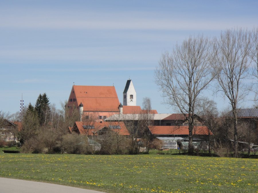
Districts and landscape
Hiking trails in the municipality invite you to explore the Allgäu countryside. One specifically described route is the Brandlemoos loop: it is about 5.5 kilometres long, crosses gently undulating terrain and starts at the car park of the Gasthof Hirsch Felderwirt in Unterthingau. Its length, terrain and starting point give you concrete details to consider when planning a hike during your stay. The distance is approximate; the route is described as a hiking trail.
Another named route is the Moorwald loop. It runs from Oberthingau to Unterthingau and then via Hauptmannsgreut back to Görisried. This clearly identifies several place names and their order along the route.
Outdoor swimming and excursions
An outdoor swimming pool is available in Unterthingau during the summer months. On hot summer days, it is also an option for a swim at the end of a bike ride. This makes the pool a seasonal part of the local leisure facilities; check current operating details before your visit. This does not mean that it is available year-round.
The local hiking trails and the Brandlemoos loop offer different kinds of guidance: the trails in the municipality let you explore the landscape, while the loop is described in more detail, with its approximate length, terrain and starting point. If you are weighing up activities for different days, you can consider these details separately. The outdoor pool adds an option specifically for the summer months and, in hot weather, can also be a place to visit at the end of a bike ride.
Local history and public functions
Unterthingau Castle serves as the seat of the municipality and the administrative association. It is also used as a library and by clubs. It is therefore not only a historic landmark in the village but also has municipal and cultural functions. The medieval market in Unterthingau takes place every four years, so this recurring event is not held annually.
The history of St. Nicholas Church also goes back a long way: its predecessor church was built as early as around 800 AD. This approximate date places the church’s origins in an early historical period. Alongside the castle and the market held every four years, it contributes to a village character in which present-day public uses and historical connections exist side by side.
Unterthingau in the wider Ostallgäu region
For a broader perspective, it is important to distinguish Unterthingau’s local offerings from those available across the wider destination of Ostallgäu. The RadReiseRegion regional cycling routes extend throughout the Ostallgäu; each is 25 to 76 kilometres long, consistently signposted and dedicated to its own theme. For hikers, there are 32 local routes in the Ostallgäu that showcase special natural and village treasures. These regional details describe the Ostallgäu as a whole, not Unterthingau alone.
The wider destination of Ostallgäu also offers its own options in winter: the Alpspitzbahn Nesselwang provides access to the ski run around the 1,575-metre-high Alpspitz; the ski area has family-friendly slopes and a children’s ski area. These details refer to the specified offering in the Ostallgäu. They should be distinguished from Unterthingau’s local trails, outdoor pool and historic landmarks.
Other places in the same wider destination: Biessenhofen, Lechbruck am See, Füssen, Halblech, Roßhaupten, Nesselwang and Seeg.
Go to the wider travel overview: Ostallgäu.

