
Discover Sigmarszell
Accommodation in Sigmarszell
In Sigmarszell, the chapel in Witzigmänn and hiking trails through the municipality shape the local landscape. One particularly well-defined route is the “Brückenschlag Leiblach” hike, which leads down from the parish village to the Leiblach River.
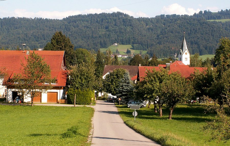
Chapel and Hiking Trails in Sigmarszell
The chapel in Witzigmänn is one of three chapels in the municipality of Sigmarszell. It is located on the road between Bösenreutin and Zeisertsweiler. Newly signposted hiking trails, such as the Leiblach Valley Hiking Trail and the Way of St. James pilgrimage route, pass through the municipality.
Hiking the Brückenschlag Leiblach
The short “Brückenschlag Leiblach” hike runs mainly along forest paths and meadow trails. From the parish village of Sigmarszell, it leads down to the Leiblach River along the Leiblach Valley Hiking Trail. On the return route, meadow trails with sweeping views lead back to Sigmarszell-Kirchdorf; the village is reached via the Zellersteg, newly built in 2004, and a short climb.
This tour includes a variety of trail sections: the descent to the Leiblach, forest and meadow paths, and the short climb by the Zellersteg. The description as a short hike and the information about the terrain give you two specific points of reference for assessing the character of the route.
Lindau as a Broader Travel Destination
The wider travel destination of Lindau also offers its own cultural, landscape, and winter attractions. Gestratz has a total of 8 kilometres of groomed cross-country ski trails. Conditions can vary from one winter to the next, so check the current trail conditions when planning your trip.
In Lindau, the New Lighthouse is 33 metres high and is reached by climbing 139 steps. The Diebsturm tower on Lindau Island was built in 1380 and served for a long time as the western end of the town’s fortifications. The lighthouse’s height and steps offer a different point of interest from the Diebsturm’s former role in the town’s defences.
In the Eistobel Nature Reserve, the water of the Upper Argen cascades downhill over several waterfalls along a 3-kilometre hiking trail. A visitor pavilion provides information before visitors descend into the gorge. The waterfalls and descent shape the landscape experience here. The panoramic cycling route on Lake Constance near Lindau offers views of especially beautiful spots by the lake and in higher-altitude areas.
The Plenterwaldweg runs from the Kurhaus Scheidegg to just before the entrance to Waldwelt Skywalk Allgäu. At nine stations, it provides information about the Plenterwald forest. The route therefore combines a clearly defined trail with a thematic focus along the stations.
The sculpture trail in Maierhöfen is an approximately 5-kilometre circular route featuring 17 sculptures and 12 text panels. Artists created the works at a symposium; they were then loaned to Maierhöfen for permanent display. The circular route thus brings sculptures and texts together on a shared cultural trail.
Discover more destinations: Hergensweiler, Weiler-Simmerberg, Stiefenhofen, Argental, Lindau, Scheidegg, Lindenberg Im Allgäu, Maierhöfen.
Back to the regional travel overview: Lindau District (Lake Constance).

