
Leśna: Landscape at Grodziec
Accommodation in Leśna
Leśna lies in the northeastern part of the Wzgórza Lewińskie, on the slopes of Grodziec, which is 803 m high. From the surrounding meadows, there are views of the Góry i Pogórze Orlickie. There is also the valley of a watercourse that feeds the Bystrą. The slopes, meadows and valley give the area different points of reference in the landscape.
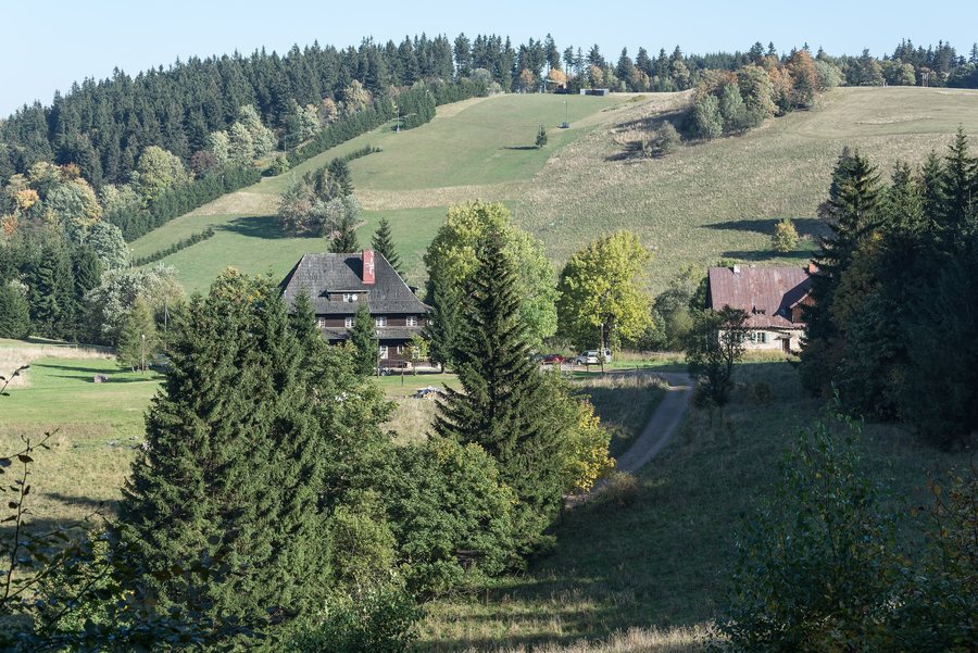
Slope, ridge and valley
The elevation of 803 m refers to Grodziec; Leśna lies on its slopes. The views of the Góry i Pogórze Orlickie are associated with the surrounding meadows, while the watercourse in the valley feeds the Bystrą. For orientation, it is helpful to keep these points of reference distinct: the mountain provides the elevation reference, the meadows the viewpoint, and the valley the connection to the watercourse.
The description of the area thus brings together several scales. The Wzgórza Lewińskie provide the landscape setting, while Grodziec is the specifically named mountain with an elevation. The valley and meadows add different features to this picture. This makes it possible to locate Leśna more precisely than a single elevation figure might suggest.
Routes around Leśna
Two route references offer different perspectives on Leśna. The Kulin Kłodzki–Lasek Miejski route passes the Leśna viewpoint. The red hiking trail from Kudowa Zdrój to Duszniki Zdrój runs through Leśna and is a section of the Główny Szlak Sudecki im. Mieczysława Orłowicza. The first route is linked to the viewpoint, while the second is defined by its course through the village and its place within a long-distance hiking trail.
The red hiking trail is listed as 15.1 km long, with a duration of 4 hours 40 minutes or 4 hours 30 minutes. This amounts to about four and a half hours; conditions along the way can affect the actual duration. The distance and times apply to this red trail. The Kulin Kłodzki–Lasek Miejski route, by contrast, can be identified by its course past the Leśna viewpoint. The route information therefore answers different planning questions: one gives a distance and time frame, the other a named viewpoint as a reference point.
When comparing the trails for your day’s plans, consider which point of reference you are looking for: the red hiking trail that runs through Leśna or the route via the viewpoint. The stated times help put the red trail into perspective; they are not a time estimate for the Kulin Kłodzki–Lasek Miejski route.
Local history across different periods
Historically, too, it is important to distinguish between different connections. Until 1595, Leśna belonged to the Homole estates. Since the modern era, the village has been part of the parish in Lewin Kłodzki. In the second half of the 19th century, Leśna lay on the route from Lewin to Grodziec and Karłów. Estate affiliation, parish membership and the historical route each describe a different connection.
The chronology helps place these local connections in context: 1595 marks the end of Leśna’s affiliation with the Homole estates; its parish affiliation dates from the modern era, and the route connection belongs to the second half of the 19th century. This keeps the historical relationships distinct rather than presenting them as one single connection.
Discover more destinations: Sienna, Poręba, Jodlow, Międzylesie, Bad Reinerz, Miedzygorze, Goworów, Młynowiec
Go to the main travel overview: Kłodzki.

