
Gravere: Meadows, Forests and Historic Places
Accommodation in Gravere
Meadows, Forests and Initial Orientation
The area around Gravere is characterized by meadows interspersed with forests and offers opportunities for nature-related leisure activities. Piazza Cesare Meano is a starting point for exploring the districts of Gravere.
The Miniera del Rugèt is an old silver mine in the Arnodera district. The explored tunnel network of the Miniera del Rugèt is approximately 450 metres long. Telephone reservations are required to access the Miniera del Rugèt; visitors are accompanied by an authorized guide. The reservation and accompaniment details are therefore particularly important when planning a visit.
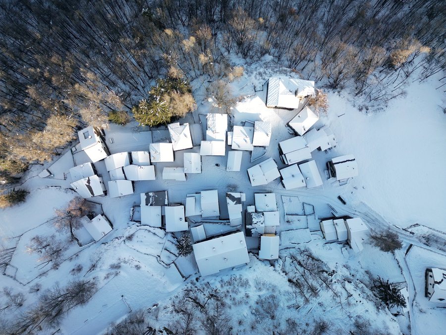 File:Gravere - Certosa della Losa - 2025-09-29 16-05-01 002.jpg
Photo: Federico_Milesi via Wikimedia Commons, CC BY-SA 4.0
File:Gravere - Certosa della Losa - 2025-09-29 16-05-01 002.jpg
Photo: Federico_Milesi via Wikimedia Commons, CC BY-SA 4.0
Silver Mine and Certosa di Madonna della Losa
According to tradition, Benedictines had already settled at the Certosa di Madonna della Losa in the 9th century. The chapel of the Certosa di Madonna della Losa is dated to the middle of the 9th century. From the parking area in Madonna della Losa, the Certosa di Madonna della Losa can be reached on foot along a level path of approximately 200 metres. This makes it possible to combine a visit to the historic complex with a short walk between the parking area and the Certosa.
Military Installations and Case Eremitani
The Batteria Militare del Trucco, also called Batteria della Losa, was built in 1891. The Batteria Militare del Trucco consisted of a trench enclosing two separate batteries on two different elevations. The two batteries were connected by an internal road that provided access to an observation post.
The Case Eremitani are an old group of houses where hermits lived. The Case Eremitani may have been a place used by the Carthusian monks of Losa for prayer, study and craftwork in seclusion. To find your way to the Case Eremitani, the road to Pian Gelassa branches off the SP254 at kilometre 7+800. At the third hairpin bend, a path leads to the Fontanette alpine pasture; the Case Eremitani are approximately 100 metres farther on the left.
Further Historic Destinations in the Surrounding Area
Forte di Exilles is a fortress in the area around Gravere. Abbazia di Novalesa is a monastery in the area around Gravere. Chiesa Santa Maria Maggiore is a church in the immediate vicinity of Gravere.
Monte Orsiera is a peak in the wider regional area around Gravere. Rocciamelone is a mountain in the wider regional area around Gravere. Cime de Bard is a peak in the wider regional area around Gravere. Pointe Baraccon de Chamois is a peak in the wider regional area around Gravere. Fort de La Turra is a fortress in the wider regional area around Gravere.
Further destinations: Claviere, Caprie, Usseaux, Val Della Torre, Carella, Sauze Di Cesana, Bobbio Pellice, Pragelato
To the higher-level travel overview: Turin.

