
Auengrund: Discover forest trails, landscapes and history
Accommodation in Auengrund
Explore Auengrund via nature trails, the landscape around Wiedersbach and traces of history at various locations. If you are looking for accommodation, first consider which themes you want to shape your trip: hiking and cycling, scenic impressions, or history and culture. The following pointers will help you plan your days out around your interests.
Forest Trails and Landscapes in Auengrund
One specific hiking destination is the 7.5 km-long “Crocker Kesseltal” nature park trail. It winds up and down over around 200 metres of elevation gain around Crock and passes through a varied natural landscape on the southern slope of the Thuringian Forest. Both the route length and undulating elevation profile offer guidance for planning; the trail combines these details with a diverse landscape.
In addition to this named route, unspoilt hiking trails through extensive woodland areas in Auengrund invite you to hike and cycle. Walking and cycling are therefore among the activities available locally. You can plan your stay around hikes, cycling tours or a mix of both.
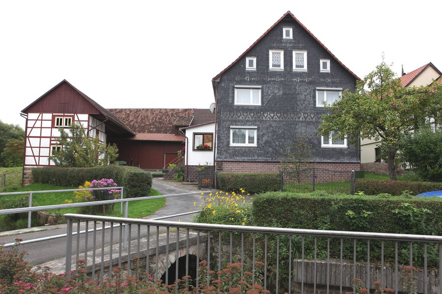
Wiedersbach lies in the valley of the stream of the same name, is surrounded by mountains and is located in the Hildburghäuser Wald Landscape Conservation Area. The Elsterbachtal and Dinkelshaak nature reserves, the Wiedersbach wetlands and the Ratscher Reservoir surround the village. These landscape features give Wiedersbach its own character when planning a trip: the valley, surrounding mountains and named protected and natural areas take centre stage here.
Local History and Traditional Stories
The church tower in Wiedersbach dates from 1601. Near Poppenwind is a hill called Vogelherd, which is associated with an older tradition: it is said that a castrum or Henneberg castle stood there even before the village was settled. Oral legends are still linked to this possible historical site today. The different levels of certainty in the two accounts are important: the date of the church tower is specific, while the earlier castle is described as a possibility in local tradition.
A landwehr was built in the Poppenwind district and was formerly also called “Lampr”. Another historical detail concerns Crock: in the 1970s, local associations took the initiative to build a swimming pool and an open-air stage offering cultural and leisure activities. Schwarzbach has a karting track described as the largest outdoor karting track in southern Thuringia. Together, these different topics show how local history, traditional tales and leisure history each offer a different way to discover the region.
More Things to Explore in the District of Hildburghausen
Beyond Auengrund, the district of Hildburghausen has its own destinations for exploring the wider region. The Hennebergisches Museum Kloster Veßra is a six-hectare open-air museum. Its four themed areas cover the history of the monastery, half-timbered architecture and everyday life in the Henneberg region, as well as agricultural technology and sustainability. The German Castle Museum at Veste Heldburg explores the history and culture of castles in Europe from the Middle Ages to the present day. Its permanent exhibition takes the form of a tour through the entire castle and shows how castle construction changed from one era to the next.
The district of Hildburghausen also features distinctive landscapes: it includes a continuous woodland area in the Thuringian Forest Nature Park, as well as the Vessertal Biosphere Reserve. In the Rodachaue heath landscape, the roof of the observation shelter offers panoramic views across the meadows. Konik horses and Heck cattle contribute to the development of a natural landscape there. These examples complement the local trails and historical traces with regional nature and museum themes, without conflating them with Wiedersbach’s distinctive landscape features.
Your choice can therefore reflect your own travel plans.
Discover more destinations: Wiedersbach, Brattendorf, Heubach, Masserberg, Sankt Kilian, Schnett, Sachsenbrunn, Fehrenbach.
For the regional travel overview: Hildburghausen-Suhl.

