
Nennslingen: Jura Houses, History and Trails
Accommodation in Nennslingen
Nennslingen combines distinctive architectural history with opportunities for hiking and cycling. The village’s historic houses and parish church are specific points of interest for a stay; the Anlautertal valley and the Jura plateau offer an extensive network of cycling and hiking trails. In summer, there is also a place to swim at nearby Bechthaler Weiher below the castle ruins. More far-reaching destinations in the Weißenburg-Gunzenhausen district are listed separately.
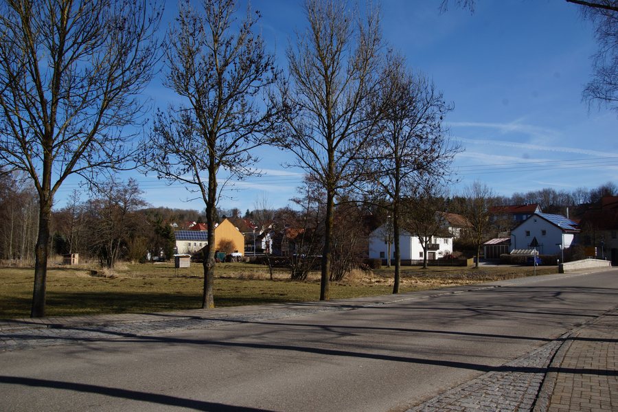
Historic Houses and Parish Church
A Jura farmhouse stands at the northern edge of the market square, with its core dating from the 16th century. It is a combined dwelling and livestock building: in this type of building, living quarters and a stable were combined. Wooden joints have been preserved in the historic roof structure. The house offers a specific glimpse into traditional construction; the building’s features alone do not indicate whether visitors may enter.
The dwelling with a smithy at Kellergasse 1 is also part of the village’s architectural history. The older half of the semi-detached house probably dates from shortly before 1540. This date is an estimate, not a confirmed year. Together with the farmhouse on the market square, the building shows that historic details can be found in different locations and in different architectural forms.
On the south side of the Evangelical Lutheran parish church of Beatae Mariae Virginis is a burial chapel belonging to the Schenken von Geyern. Numerous epitaphs there commemorate this lower-ranking noble family. Those interested in regional history will find a specific connection to the family to whom the burial chapel is dedicated, alongside the church building’s architecture.
The artwork “The Lost Village” explores a different subject in the municipality. It is geographically centrally located between the four districts of Biburg, Gersdorf, Wengen, and Nennslingen, so it is not in Nennslingen itself. Four solid houses made of brushed stainless steel depict Jura houses from these places at a scale of 1:8. They commemorate demolished buildings that helped shape the local landscape for centuries in some cases. In this way, the artwork brings together the architectural history of several districts in a single representation.
Trails, Tourist Information, and Summer Recreation
The scenic Anlautertal valley and the Jura plateau near Nennslingen offer an extensive network of cycling and hiking trails. No specific trail lengths or routes are given; for finding your way around the surrounding area, the Tourist Information office provides maps of hiking and cycling trails. It is located at Schmiedgasse 1 in Nennslingen and also offers flyers and posters about current events, as well as further information.
There is a playground on Ringstraße with a climbing frame, seesaw, swing, spring rider, and carousel. As the facilities may change, it is advisable to check what is currently available before visiting. A seasonal summer option is the place to swim at nearby Bechthaler Weiher below the castle ruins. It is described as a summer offering; no other facilities or access conditions are implied.
More Destinations in the Wider Weißenburg-Gunzenhausen Region
In the wider Weißenburg-Gunzenhausen region, the Limes is a landmark extending across a large area: it runs for around 40 kilometers through the district and has been a UNESCO World Heritage Site there since 2005. Roman heritage includes numerous watchtowers, forts, and fragments of bath complexes. In Weißenburg, the Roman Museum displays Germany’s largest Roman treasure find and houses the Central Bavarian Limes Information Center. These places and attractions belong to the wider region and should not be understood as facilities in Nennslingen.
Other examples in the district include the partially reconstructed Biriciana fort and the Roman Baths, which are part of Weißenburg’s Roman heritage. Above Weißenburg, at an elevation of 630 meters, stands the Wülzburg, an old Ansbach Hohenzollern fortress and a monument to Renaissance fortification. Weather permitting, guided tours are offered there from May to October; check the dates before your trip. The southern part of the district lies within the Altmühltal Nature Park. This regional description does not automatically mean that every place mentioned is located in the nature park.
Different Tours in the District
When planning a trip around the wider region, the routes mentioned can be distinguished by activity and length. The “Via Biriciana” hiking trail in Weißenburg follows old Roman roads to the Limes. The Altmühltal Panorama Trail is 200 kilometers long and runs along the Altmühl from Gunzenhausen to Kelheim through the Altmühltal Nature Park. It is certified as a “Quality Trail Wanderbares Deutschland”; if this formal status matters to your plans, check that it is current.
For cyclists, the Altmühltal Cycle Route runs for around 160 kilometers from Gunzenhausen to Kelheim through the Altmühltal Nature Park. Another, different option is the Altmühl canoe route, which is just under 120 kilometers long between Gunzenhausen and Dietfurt/Töging. Navigational conditions may vary seasonally, so it is advisable to check before setting out. These routes are examples of the wider region and do not imply any connection to Nennslingen.
Swimming, sailing, and surfing are also mentioned at Altmühlsee, northwest of Gunzenhausen. The roughly 120-hectare bird island offers ornithological tours organized by the Bavarian Society for the Protection of Birds; check their availability before your trip. The regional examples therefore have clearly distinct focuses: Roman history, hiking, cycling, canoeing, and nature watching complement the local attractions of Nennslingen.
Discover more destinations: Burgsalach, Muhr Am See, Thalmannsfeld, Weißenburg In Bayern, Gunzenhausen.
Return to the wider travel overview: Weißenburg-Gunzenhausen.

