
Obersöchering: Churches, Historic Buildings and Routes
Accommodation in Obersöchering
Obersöchering combines distinctive church and historic building styles with opportunities for hiking and cycling. Building history and route layouts provide concrete points of reference for getting your bearings: the buildings differ in period and architectural details, while the routes include both circular hikes and a cycling route.
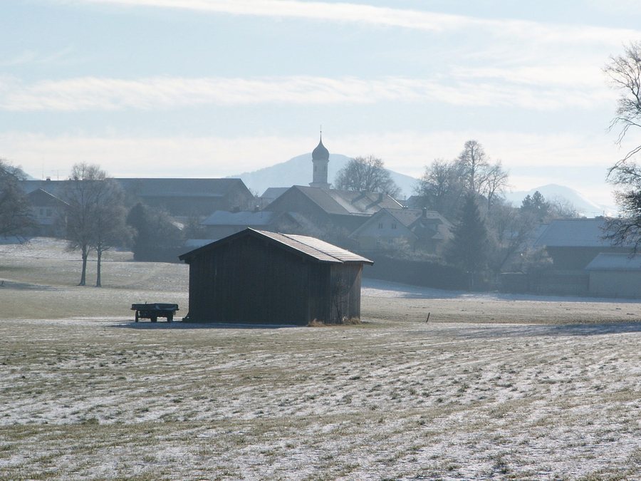 Obersöchering from the northwest on a winter morning
Photo: Flodur63 via Wikimedia Commons, CC BY-SA 4.0
Churches and Historic Buildings in Obersöchering
The Catholic branch church of the Assumption of Mary, also known as the Liebfrauenkirche, is listed as a historic building. Its core is a Romanesque choir-tower church dating from around 1200. The Catholic parish church of St Peter and Paul offers a different architectural feature: it has a recessed, polygonal choir in the Late Gothic style. These building forms reveal the difference in period between the Romanesque core and the Late Gothic choir, without reducing the two churches to the same feature.
At Habacher Straße 2, there is a war memorial commemorating the First World War and the house plaque of the former rectory. The memorial depicts an over-life-size Saint Sebastian on a tall pedestal; it also includes a small fountain basin and name plaques. The house plaque at the same address bears the year 1639. Thus, a memorial to the war and a precisely dated reference to the former rectory stand side by side at this location.
Further examples of architectural styles can be found on Hauptstraße. The residential section of the former farmhouse at number 2, which is listed as a historic building, is a two-storey rendered building with a carved upper loggia and a projecting gabled roof in Neo-Gothic forms; it is dated 1869. The core of the inn at number 4, also listed as a historic building, dates from the late 18th century. The long, two-storey building is described as a single-ridge farm with a shallow-pitched gabled roof. The comparison brings the village’s different architectural forms and periods into view, from the late medieval date on the house plaque to the architectural styles of the 19th century.
Hiking Routes and Cycling Route
A gentle, almost flat circular route through the Filze is described as being 9.7 kilometres long. It runs mostly along paved farm tracks. Its length, gentle gradient and predominantly paved surface provide concrete guidance for planning a day out. Another circular route, the “Pfaffenwinkel Obersöchering” hike, starts at the car park by the sports ground near Obersöchering, goes around the Pollinger Weiher and returns to the car park. Check the conditions for this route before setting off.
The “Riegseerunde” cycling route also passes through Obersöchering. From there, it continues along a cycle path towards Habach and Sindelsdorf. The options therefore offer different ways to get around: the circular hike through the Filze, the loop around the Pollinger Weiher and a cycling route that continues towards Habach and Sindelsdorf. This information helps you consider hiking and cycling plans separately, rather than attributing the same route to both.
Setting in Weilheim-Schongau
The wider travel destination of Weilheim-Schongau is located in the Pfaffenwinkel travel region. At this regional level, the Lech forms Weilheim-Schongau’s western boundary; the Ammer flows through its central area, and the Loisach runs along its eastern boundary. This orientation applies to Weilheim-Schongau as the wider travel destination and does not describe the location of individual features in Obersöchering.
Discover more destinations: Sindelsdorf, Antdorf.
Go to the wider travel overview: Habach.

