
Unteregg: Church, Village Culture and Walking Routes
Accommodation in Unteregg
Get to know Unteregg through St. Martin’s Parish Church, the buildings on Kirchstraße and local club life. For excursions, it is worth considering the geographic layout: some routes are within the municipality, while others pass through Oberegg or lead to destinations outside Unteregg.
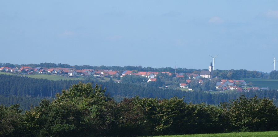
Church and Historic Ensemble
The Catholic Parish Church of St. Martin is at Kirchstraße 10. The unplastered building, made of tuff blocks, is designed as a hall church with a narrower chancel; the tower with its pointed spire stands to the north. The church dates from the 15th century and bears the date 1477; it was remodelled around 1720/30. The technical term “narrower chancel” describes a chancel that is narrower than the main hall. The church marks the early settlement of the projecting spur of land above the Mindel Valley. Together with the historic vicarage and the Adler inn, it forms an ensemble.
Another historic building is the vicarage at Kirchstraße 11: a two-storey building with a hipped roof, dating from around 1780, with a moulded wooden eaves cornice. The church and vicarage illustrate different architectural forms and periods. The church is notable for its medieval origins and later remodelling, while the vicarage is described simply in terms of its roof shape, number of storeys and cornice.
Music and Village Traditions
With almost 50 active musicians, the Unteregg-Oberegg Music Band plays an important role in cultural life. The Maibaumfreunde are also part of local tradition: for many years, they have been known for their imaginatively decorated Maypoles, which have often received the highest awards. The church, music and Maypole tradition offer different insights into village life, without requiring you to plan around an event date.
Routes in the Municipality
The “Around the Three-Country Stone” hiking trail runs for 16 kilometres through woodland and open countryside. Explanatory signs stand at the three-sided boundary marker. The Three-Country Stone itself is in the woodland of the Warmisried/Bayersried district, by the lower Schwarzenbach. The boundary stone, made of red marble, dates from 1791.
The Crescentia Pilgrimage Route covers a different distance: this circular route of about 90 kilometres runs from Kaufbeuren via Mindelheim and Ottobeuren and back to its starting point. It passes directly through Oberegg, not through the central village of Unteregg. The routes’ different lengths and locations can help you distinguish between them when choosing one for your stay.
There are also water-treading basins in Eßmühle and Rappen within the municipality. Check local conditions before visiting. This way, the places mentioned can help guide your planning, while the specific possibility of visiting them should be confirmed locally.
Destinations Nearby
Outside Unteregg, nearby, lies the Teufelsküche geotope in the valley of the eastern Günz. Large blocks of compacted glacial-period gravel, piled up in a wild jumble, define the geotope. It is designated as a natural monument; visitors should stay on the paths.
The Katzbrui Mill is an agricultural grain mill dating from the 17th century. For the walk there, the municipality recommends starting in Unteregg. Alternatively, you can drive to the car park and walk the final 100 metres; check the route details locally before your visit. In Mindelheim’s historic old town, the town hall, remodelled in the historicist style in 1897, is another nearby point of interest.
Accommodation and the Regional Context
The Gasthaus Goldener Adler is at Kirchstraße 14 in Unteregg. Check whether it is currently open before travelling. The Preißinger holiday and seminar farm is at Obere Hauptstraße 55; check availability directly.
In the wider travel region of Unterallgäu, cycle and hiking trails throughout the district are consistently signposted; the region also has the Glückswege trails. This regional information complements local guidance for Unteregg, but describes Unterallgäu as a whole.
For the wider travel overview: Dirlewang.

