
Schöllkrippen: Orchard Trail and Cultural Circular Routes
Accommodation in Schöllkrippen
First consider whether nature themes or a cultural route will be the focus of your stay. The approximate lengths and described waypoints help you distinguish between the options.
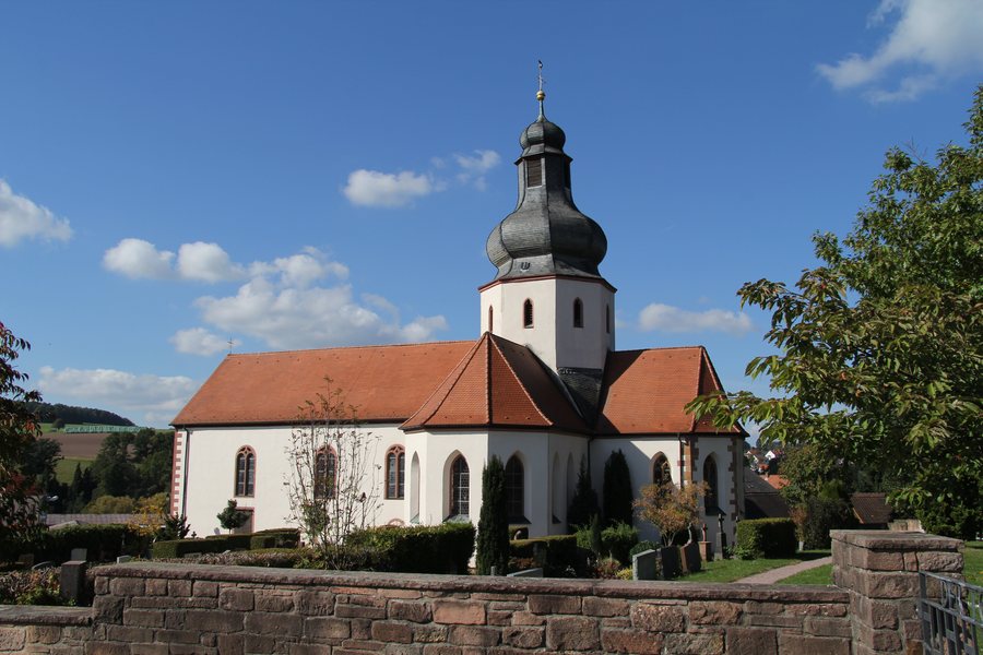 File:Schöllkrippen - St. Katharina Ernstkirchen.jpg
Photo: Maulaff via Wikimedia Commons, CC BY-SA 3.0
Orchard Experience Trail: Nature and History of Use
East of Schöllkrippen, the Orchard Experience Trail passes through traditional orchard meadows and grasslands. Its 14 stations cover the origins and history of the use of traditional orchard meadows, as well as typical plant and animal species. The topics are presented in a playful way. The trail thus connects its landscape with interesting facts about its history and biodiversity.
The circular trail is about two kilometres long. It starts above the Schützenhaus, by the mobile hut of the Äbbelwoistammtisch Schöllkrippen. Its length and circular format provide a clear basis for your choice: the focus is on a compact route and the themes of traditional orchard meadows.
Cultural circular routes and their waypoints
The European Cultural Circular Route Schöllkrippen 2 is about six kilometres long. It starts and ends at the Schöllkrippen natural swimming pool and passes the “Alte Burg” rampart on Reuschberg. This means the start and finish are the same named place; along the way, the rampart is one of the route’s described landmarks.
The Pasquillen Trail is a cultural circular hiking route in Schöllkrippen. It passes the Kalmus viewpoint and the railway station, then continues to the “Dreigestirn” (“Three Stars”) comprising St Luke’s Chapel, the town hall (Old Castle) and Sackhaus. The sequence of named points makes this cultural route especially easy to identify by its stops.
Of the two circular routes with stated lengths, the Orchard Experience Trail is about two kilometres long, compared with about six kilometres for Schöllkrippen 2. For the Pasquillen Trail, the viewpoint, railway station and three buildings instead provide specific guidance on its route. Depending on whether the themes of traditional orchard meadows, the rampart or the named stops along the Pasquillen Trail matter most to you, you may choose a different route.
Cycling and hiking routes in the broader destination of Aschaffenburg
The broader destination of Aschaffenburg also offers cycling routes with different descriptions. The family-friendly MainRadweg runs through the Maintal valley in the district of Aschaffenburg and is well signposted. The Kahltal-Spessart cycle route is also signposted and passes through the district’s landscapes. You can check signage and local route conditions before setting out.
For cross-country cycling, four challenging routes in the eastern Hochspessart area of the district are signposted as Bikewald-Spessart routes. This is a different kind of ride from the described cycle routes through the Maintal valley and the district’s landscapes. Check local route conditions before your ride.
The regional hiking options also extend beyond a single day hike: Spessart Trails 1, 2 and 3 run through the district of Aschaffenburg and have already received the “Qualitätswege Wanderbares Deutschland” (“Quality Trails Wanderable Germany”) award four times. The Eselsweg is a multi-day hike in the district. If the current status of an award is important to your plans, check it before your hike.
The “Denk mal – Rad mal” app offers cycling excursions in nature around the district, with stories, quizzes and information about sights. Before travelling, check whether the app and its content are available. It adds digital stories and quiz elements to the route information.
Landscape and regional dining
As a scenic backdrop in the broader destination of Aschaffenburg, the Spessart in the district is described as an extensive mixed forest area that forms part of the largest of its kind in Germany. The nature trails and routes are therefore set within a regional landscape that extends beyond the individual waypoints in Schöllkrippen.
Franconian cuisine is also part of the regional picture: numerous inns and hotels in the district of Aschaffenburg serve Franconian specialities and Äppelwoi from local cider presses. This information applies to the district, not to individual establishments in Schöllkrippen. When choosing accommodation, you can use the described trails as local points of reference and consider the regional landscape and cycling or hiking routes as an additional backdrop to your stay.
Discover more destinations: Blankenbach, Hösbach, Krombach and Johannesberg.
Back to the main travel overview: Aschaffenburg.

