
Neuenweg on the southern slope of the Belchen: forests, trails and history
Accommodation in Neuenweg
Neuenweg lies in the uppermost section of the Kleine Wiese valley on the southern slope of the Belchen and is surrounded by extensive forests. Specific destinations in the village and along the trails include the Belchen Southern Slope Circular Trail, Nonnenmattweiher, Neuenweg Church and the mountain passes into the surrounding area.
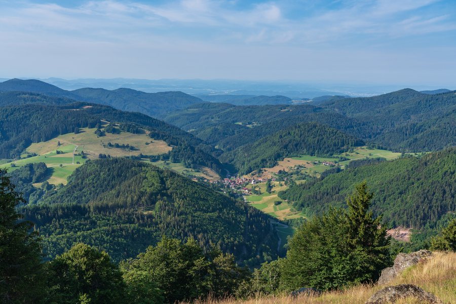 File:Kleines Wiesental - Neuenweg - Blick auf Neuenweg vom Belchen.jpg
Photo: PantaRhei via Wikimedia Commons, CC BY-SA 4.0
File:Kleines Wiesental - Neuenweg - Blick auf Neuenweg vom Belchen.jpg
Photo: PantaRhei via Wikimedia Commons, CC BY-SA 4.0
Landscape on the southern slope of the Belchen
Its location in the upper section of the Kleine Wiese valley connects the village centre with the forest landscape on the southern slope. Nonnenmattweiher formed in a cirque created by glaciers. A cirque is a bowl-shaped landform shaped by glaciers; the lake therefore lies in a landscape whose present-day form dates back to the Ice Age. At the beginning of the 18th century, the cirque lake was artificially dammed. As a result, part of the boggy cirque floor became detached, creating a floating peat island.
Neuenweg is home to a very old and very broadly grown pasture beech.
Hiking destinations with different time requirements
The Belchen Southern Slope Circular Trail is 11.2 kilometres long and includes 750 metres of elevation gain. On the way to the Belchen, the circular trail is marked with the yellow diamond of the Black Forest Association and initially leads to the Sternschanze. With 750 metres of elevation gain, you should consider not only the distance but also the ascents when planning your day and schedule breaks.
From Neuenweg, Nonnenmattweiher can be reached both by a short hike and by a full-day hike. The short hike fits within a limited time frame, while the full-day option takes up more of the hiking day.
Historical traces in the village and along the trail
The Belchen Southern Slope Circular Trail passes another historical landmark, the Old Border Wall. The trail leads past its moss-covered remains. The wall consists of stones stacked on top of one another and is still preserved at this point at just under 1 metre high.
Neuenweg Church stands in the village itself. Construction began on 17 June 1807, the work was essentially completed by 2 December 1807, and the church was consecrated in the first half of 1808. The church combines the building history of the early 19th century with the older grave slab from 1692.
A grave slab from 1692 is also set into the church’s right exterior wall. It commemorates an imperial officer who was buried in Neuenweg and directed the construction of the fortifications on the Hau on behalf of Austria and the “Türkenlouis”. During the holiday season, the church was open during the day.
Mountain passes and regional orientation
Neuenweg lies on three mountain passes. The western connection to the Rhine Valley divides at the “Haldenhof” inn: one road leads via the Sirnitz to Badenweiler, while another leads via Münsterhalden and Münstertal to Staufen. To the east, the route leads over the Hau into the Große Wiesental valley to Schönau and continues via Todtnau to the Feldberg. To the west are the routes to Badenweiler and Staufen; to the east is the route via Schönau and Todtnau to the Feldberg.
Further information about Elbenschwand.
For the overarching travel overview: Kleines Wiesental.

