
Elbenschwand between Forest, Hamlets and History
Accommodation in Elbenschwand
Elbenschwand combines forest and open-land landscapes with hamlets, farm clusters and individual farms. It is also home to a historic memorial in the Elbenschwand Forest and the Elbenschwand Memorial Circular Trail.
Landscape: Lowland beech forest on brown earth soils or skeletal, shallow raw soils, species-poor mixed fir forest from around 800 m, as well as pastures and meadows shape the landscape; Settlement: Elbenschwand consists of hamlets, farm clusters and individual farms in the valley and on flattened slopes; Location: The main village area extends high above the Kleine Wiese and along the stream between Bürchau and Tegernau; Getting there: Between Langensee and Bürchau, the road to Elbenschwand branches off to the right about 1 km from the L 139; History: A memorial to the 1945 werewolf murders is located in the Elbenschwand Forest.
Landscape with clear transitions
Elbenschwand's landscape is shaped by lowland beech forest on brown earth soils or skeletal, shallow raw soils, species-poor mixed fir forest from around 800 m, and pastures and meadows on gentle slopes, level areas and in hollows.
Elbenschwand's landscape does not have a uniform forest character. In the lower areas, beech forests grow on brown earth soils or skeletal, shallow raw soils. From around 800 m, the landscape changes to species-poor mixed fir forest. Pastures and meadows complement these forest areas on gentle slopes, on level areas and in hollows.
Hamlets, farm clusters and individual farms
The settlement pattern is characterized by hamlets, farm clusters and individual farms. These forms are located in the valley and on flattened slopes high above the Kleine Wiesental on the northwestern slope of the Zeller Blauen. This creates a structure composed of several settlement forms.
Hamlets, farm clusters and individual farms are distributed across the valley and the flattened slopes. The northwestern slope of the Zeller Blauen provides the overarching hillside reference, while the Kleine Wiesental denotes the valley location. The elevation and the flattened slopes are therefore just as much part of the spatial context as the individual settlement forms.
Spatial orientation on site
The Elbenschwand locality consists of the named areas of Elbenschwand, Holl and Langensee. Its main village area extends high above the Kleine Wiese and along the stream between Bürchau and Tegernau.
Between Langensee and Bürchau, the road to Elbenschwand branches off to the right about 1 km from the L 139. The figure of about 1 km is an approximate distance. If you would like to explore the surrounding area in the context of a broader travel comparison, you can also visit Neuenweg.
Memorial and historical references
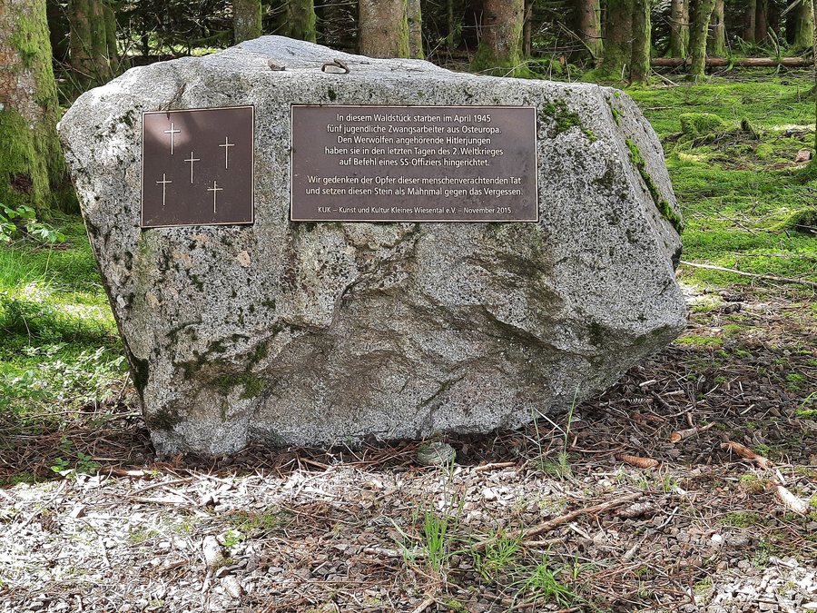
A memorial to the 1945 werewolf murders is located in the Elbenschwand Forest. The KUK initiative erected the memorial on 22 November 2015 on a voluntary basis and at its own expense.
The Monastery of St. Blasien also acquired property in Elbenschwand through the Lords of Rotenberg. The property came to the monastery through the Lords of Rotenberg.
The Elbenschwand Memorial Circular Trail
The Elbenschwand Memorial Circular Trail is a moderately difficult circular hiking route.
For the overarching travel overview: Kleines Wiesental.

