
Oberreichenbach
Accommodation in Oberreichenbach
For a stay in Oberreichenbach, hiking and cycling routes offer practical guidance for planning each day. When looking for accommodation, you can first consider whether you would prefer a circular hike, a cycling tour or—if there is enough snow—cross-country skiing. The different starting points, walking times and route details can help you choose activities for your stay.
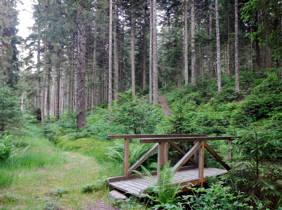
Hiking: circular routes with different starting points
A circular hike lasting around 2.5 hours starts at the Oberreichenbach sports ground. It passes Kohlhütte, the Würzbach sports ground, Pflanzgartenhütte, the former Havelsburg, Föhrbrunnenhütte, Schmierofen and Kuchenbrückle before returning to the sports ground. A second circuit, also around 2.5 hours long, starts at the town hall. It passes Felsenmeer, Oberkollbach, Unterkollbach, Igelsloch and other stops before returning to Oberreichenbach. A shortcut reduces the walking time for this town hall circuit by about an hour.
A circular hike of around 2.5 hours also starts at the Bechergass car park and passes Heselwasenhütte, Becherberg, Katzensteigle, Brandmiss and Naislach before returning to the car park. The three circular routes therefore have similar estimated durations, but differ in their starting points and stops; the town hall circuit also has a shorter option. Another hiking option is a route signposted by the Black Forest Association through a Black Forest valley between Oberreichenbach and Hirsau. The listed starting points are the town hall or the Gasthaus Löwen in Oberreichenbach.
The Föhrbrunnen spring is located in the Oberreichenbach forest, where a hut invites visitors to stop and relax. This named natural attraction adds another point of interest to the hiking routes. The hut offers a place to take a break, regardless of which of the routes described you choose for the day.
Cycling routes and leisure spots
A cycling circuit of around 20.5 kilometres starts at the car park by the church or at the town hall in Oberreichenbach. It passes Altburg, Würzbacher Kreuz, Würzbach, Sauerbrunnen, Schmieh and the Habichtsfang wetland before returning to Oberreichenbach. Another cycling tour starts at the Oberreichenbach sports ground, follows the Eselsträßle past the Habichtsfang biotope and Kohlhütte, then heads towards Altburg via Würzbacher Kreuz. This gives you a choice of different routes; an approximate total distance is provided for the first one.
Named leisure spots include the Oberreichenbach Sports and Adventure Park next to Mößackerhütte. In the Unterdorf, residents created a boules court at the corner of Schulstraße and Brunnenstraße. Its location is therefore clearly identified within the village; together with the routes, these spots offer different ways to plan your days in Oberreichenbach.
Cross-country skiing when there is enough snow
When there is enough snow, the Oberreichenbach Sonnenloipen trails are groomed as circular routes in all four districts. Cross-country skiing is therefore dependent on snow conditions. If this activity is important to your trip, check the snow conditions for your planned travel dates.
More to explore in the wider destination of Calw
The wider destination of Calw also offers more ideas. In and around Calw, well-signposted trails and routes let you explore the Black Forest Central/North Nature Park on foot. In the village of Schömberg, within the wider destination of Calw, the barefoot park has a course about 800 metres long with more than 20 different materials; check its seasonal opening times before planning a visit. The nature trail in Haiterbach, also within the wider destination of Calw, offers children an accessible way to learn about trees and their leaves, as well as the geology of the quarry. In Haiterbach, visitors can compare the jumping power of animals at the animal long-jump attraction.
Discover more destinations: Dobel, Bad Liebenzell, Unterreichenbach, Altensteig, Höfen an der Enz, Bad Wildbad, Schömberg, Bad Herrenalb
Go to the overview of the wider destination: Calw.

