
Calw between the Nagold Valley, Gäu and Northern Black Forest
Accommodation in Calw
Calw lies in the Nagold Valley between the hilly Gäu, rich in meadows and hedgerows, to the east and the extensive coniferous forests of the Northern Black Forest Nature Park to the west. The Nagold Valley, Gäu and Northern Black Forest stand alongside one another as distinct landscape areas.
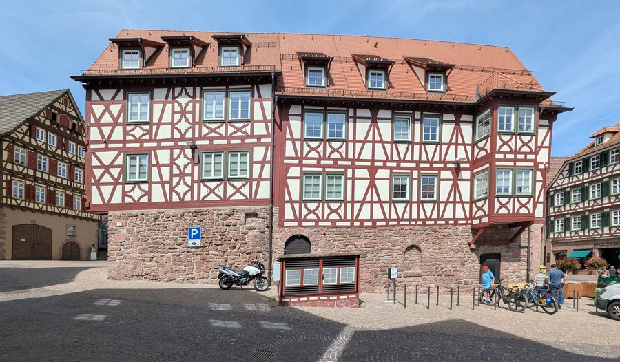 Calw-314-Salzgasse-Nr4-Marktplatz-Nr7-2026-gje.jpg
Photo: Gerd Eichmann via Wikimedia Commons, CC BY 4.0
Calw-314-Salzgasse-Nr4-Marktplatz-Nr7-2026-gje.jpg
Photo: Gerd Eichmann via Wikimedia Commons, CC BY 4.0
Landscape
The district of Calw belongs predominantly to the Northern Black Forest. Some towns in the eastern and southern parts of the district lie in the Gäu or in the Black Forest foothills. The landscape also includes the Enz and the Nagold, two important rivers in the district that contribute to the formation of the central Enz-Nagold Plateau. In addition, the district encompasses 26 nature reserves.
For geographical classification, it is helpful to distinguish between the city, the district and the surrounding region. Thus, alongside the Nagold Valley, the wooded areas, the Gäu, the Black Forest foothills, the river landscape and the protected areas stand alongside one another as distinct geographical references.
Nature and trails
The Calw municipal forest begins near the marketplace. It is intended for walks and also serves as access to an extensive hike. Calw also offers nature experience trails and paths where visitors can observe animals and plants in their natural surroundings.
A 4.9-kilometre themed trail runs through Calw’s municipal forest. It includes views from Gimpelstein over Calw and the Nagold Valley. The specific kilometre figure for this trail and the open-ended classification of an extensive hike represent two different scales for planning the day. You can therefore consider the trails either according to a set length or according to the desired scope, without equating the two options.
The themes also differ: the municipal forest represents walks and access to a longer hike, while the nature experience trails and paths focus on observing animals and plants in their natural surroundings. The themed trail complements this selection with a specifically named route through the municipal forest and the Gimpelstein viewpoint.
Culture
The Benedictine monastery of Hirsau is located in the immediate surroundings of Calw. Reuthin Monastery and Liebeneck Castle Ruins are situated in the surrounding area. Hirschkopf, Tannberg, Becherkopf and Brennerberg are also located in the area surrounding Calw. Altensteig Castle lies in the wider regional surroundings.
The cultural and landscape sites mentioned can be distinguished according to three spatial levels: immediate surroundings, surrounding area and wider regional surroundings. This classification provides an objective basis if you wish to consider individual destinations not only by their theme but also by their geographical relationship to Calw.
When considering accommodation in Calw, first compare the travel dates, room category and cancellation conditions on the respective offer page. These three details help you determine the timing and organisational framework of your stay, while trails, natural areas and cultural sites can be classified independently according to their geographical relationship.
Other places at this geographical level: Dobel, Neuweiler, Altensteig, Enzklösterle, Bad Wildbad, Unterreichenbach, Bad Liebenzell, Bad Herrenalb, Höfen An Der Enz, Oberreichenbach, Simmersfeld, Schömberg.
Getting there
The Hermann Hesse Railway is considered a car-free way to reach Calw and improves connections between Stuttgart and the Northern Black Forest. This provides a regional transport connection alongside the landscape, trail and cultural connections.
For the higher-level travel overview: Baden-Württemberg.

