
Trois-Ponts: Rivers, Routes and Regional Experiences
Accommodation in Trois-Ponts
Trois-Ponts can be identified by a distinctive geographical feature: the Amblève, Salm and Bâleur rivers meet here. When choosing accommodation, local trails, excursions and visits can help guide your decision. The options vary considerably: there is a five-kilometre walking trail, a driving route with two loops, trail networks and mountain bike routes. There is also an observation tower, a museum and a distillery, visits to which can be arranged in advance. When planning, consider which of these experiences you want to make the focus of your stay.
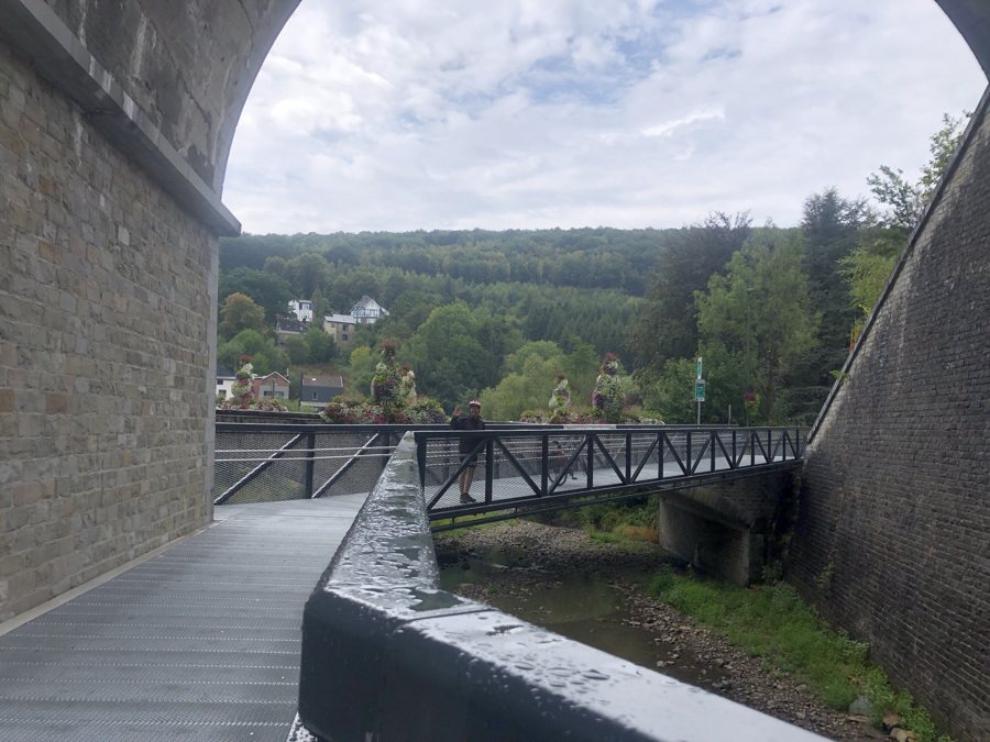
Riverside scenery and a pilgrimage route
The Via Arduinna, one of the pilgrimage routes to Santiago de Compostela, passes through Trois-Ponts. Within the town, it also passes the Faix du Diable site. This means a well-known regional pilgrimage route and a named local landmark lie along the same route. If you are interested in pilgrimage routes, this connection gives you a specific reason to consider including the Via Arduinna in your plans.
A flat walking trail and other routes
The five-kilometre walking trail starts at the Coo-Trois-Ponts hydroelectric power station. It is completely flat and accessible with a pushchair or wheelchair. Check local accessibility conditions before your visit. This makes it possible to distinguish this trail from the other route options based on its length and described features, without treating it as part of a longer trail network.
The Route des Panoramas is a 50-kilometre driving route with two loops of 25 kilometres each. It passes through Basse-Bodeux, Logbiermé, Mont Saint Jacques and Wanne. Together, the two loops make up the stated total distance. This gives you clear distances for planning a drive through the named places.
The Extratrail network consists of connected routes of 10, 17, 23 and 37 kilometres, starting at the Syndicat d’Initiative. There are also three mountain bike routes measuring 11, 15 and 34 kilometres. If route length is an important factor in your choice, you can compare the stated distances directly: the Extratrail network ranges from 10 to 37 kilometres, while the mountain bike routes range from 11 to 34 kilometres. These are separate options, not one shared route.
Views and visits to plan in advance
The Tour Leroux offers a different focus from the routes: the 17-metre-high wooden tower provides panoramic views over the Salm Valley region and its surroundings. It adds a view of the landscape to the route-length information. The Musée de la Haute Ardenne is in Wanne, Trois-Ponts. Educational activities and guided tours are available there by prior reservation. If a guided tour suits your stay, make sure to book in advance.
A distillery in Trois-Ponts can also be visited by arrangement and offers a tasting. Arrange your visit before you arrive and confirm availability. This condition should be taken into account when planning your visit; it distinguishes the distillery visit from the routes, whose lengths and courses are described.
Getting there and finding accommodation
Trois-Ponts has a railway station, bus connections and access to the RAVeL network. Check timetables before setting off, as they may change. This lets you focus your search on the activities you want to shape your stay, without confusing different options.
Discover other destinations: Basse-Bodeux, Wanne, Büllingen, Jalhay, Bütgenbach, Spa, Lierneux, Stavelot.
Back to the main travel overview: Liège.

