
Plenzengreith: Village History and Hiking
Accommodation in Plenzengreith
Plenzengreith lies on a rise between the Schöcklbach and Wölling. Its character can be understood from two different perspectives: the history of the village and the landscape around the Schöckl. The local history and the routes described here offer specific points of interest for a stay. The easy hike “Schöckl Round from Schöcklkreuz (Plenzengreith)” leads from Schöcklkreuz up to the summit plateau; in the Mühlgraben section of the Stenzengreith themed trail, a mountain stream and a small waterfall take center stage.
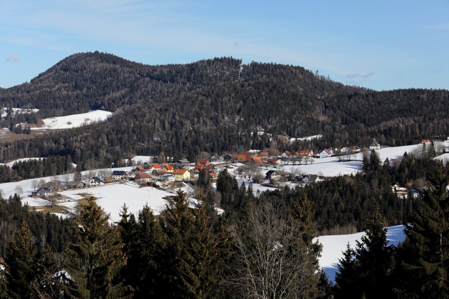 File:Plenzengreith 294A6241 Steiermark.jpg
Photo: Christian Pirkl via Wikimedia Commons, CC-BY-SA-4.0
Location Between a Rise and Watercourses
The elevated setting is a distinctive part of the village’s description. Plenzengreith lies between the Schöcklbach and Wölling; east of the village, the upper course of the Schöcklbach cuts deeply into the landscape. The Wöllingbach rises at Kalte Rinne. Together, these features encompass several aspects of the landscape: the rise, a deeply incised upper course of a stream, and a named source. The details offer different reference points: the village’s elevation, the upper course of the Schöcklbach to the east, and the source of the Wöllingbach at Kalte Rinne. This makes it possible to describe the landscape both from the settlement and from its watercourses.
The Settlement History of Plenzengreith
The cadastral municipality of Plenzengreith was first mentioned in writing in 1265 under the name Plenssenreut. The village itself was originally a single-row settlement adapted to the terrain; the present-day settlement pattern developed in three stages. These details concern different aspects: the date refers to the first written mention of the cadastral municipality, while the term “single-row settlement adapted to the terrain” describes the village’s original form. “Single-row” refers to a settlement laid out in a line; the description as a settlement adapted to the terrain also takes the landform into account. The present-day settlement pattern marks a further point in its development, as it emerged in three stages. Thus, the local history connects the recorded name, the original settlement form, and the development of the present-day pattern without treating these as equivalent. For travelers interested in cultural history, the story is about more than an early date: it also concerns the village’s spatial form and development.
Hiking: The Schöckl and Mühlgraben
At 1,445 m, the Schöckl is one of the highest elevations in the Almenland Nature Park in Styria. Described as easy, the “Schöckl Round from Schöcklkreuz (Plenzengreith)” hike leads from Schöcklkreuz up to the summit plateau. This provides a clear destination on the Schöckl. The Mühlgraben section of the Stenzengreith themed trail follows a picturesque mountain stream and offers a place to rest beside a small waterfall. The two descriptions emphasize different things: the hike leads to the summit plateau, while the themed trail section highlights the mountain stream and the place to rest by the waterfall. When choosing an outing, you can therefore follow the landscape feature that interests you most.
Discover more destinations: Anger, Sankt Georgen, Birkfeld, Fischbach, Rettenegg, Sankt Kathrein Am Offenegg Ii.Viertel, Breitenau, Passail
See the regional travel overview: Weiz.

