
Etroubles: Mountain Landscape, Trails and Cultural History
Accommodation in Etroubles
Alpine Landscape and Surroundings
Etroubles lies at an altitude of 1,270 metres in the alpine valley of Gran San Bernardo and is surrounded by extensive forests and green pastures. The altitude, wooded areas and open pastures shape the landscape around the village. The mountains Mont de la Tza, Pointe de Metz, Testa di Crevacol and Becca France are located in the surroundings of Etroubles. The ruins of Le Crêt are also located in the surroundings of Etroubles.
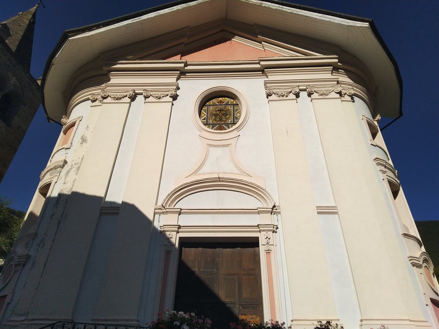 File:Etroubles - Chiesa di Santa Maria Assunta - 2023-09-28 21-15-11 001.jpg
Photo: Ruparch via Wikimedia Commons, CC BY-SA 4.0
File:Etroubles - Chiesa di Santa Maria Assunta - 2023-09-28 21-15-11 001.jpg
Photo: Ruparch via Wikimedia Commons, CC BY-SA 4.0
Summer Hike and Nature
The Etroubles–Bruson route, described as a summer hike, passes through meadows and a cool forest. In the early morning hours, deer may be encountered on the hike. Anyone wishing to plan for a possible wildlife sighting should take into account the early morning hours and the route’s alternation between meadows and cool forest. The route therefore passes through two clearly named landscape sections and mentions possible wildlife contact at a specific time of day.
Culture, Production and History
Cultural and historical attractions include the Torre di Vachéry, a 12th-century tower in the hamlet of Vachéry. The Latteria Turnaria, founded in 1853 as the region’s first turnaria dairy, now houses a museum about the production of Fontina, butter and Séras, featuring the original tools from that period.
The Centrale Bertin was redesigned as an ecomuseum and documents the transition of the rural communities of the Gran San Bernardo Valley to modern times. The Via Francigena later developed along the ancient Via delle Gallie, which passed through Etroubles. Thus, the development of historic routes is also part of the history associated with Etroubles.
Trails with Different Profiles
The Etroubles–Saint-Oyen health trail runs for 2.1 km from Etroubles to Saint-Oyen and has an elevation difference of 79 m. The easy Etroubles–Saint-Oyen health trail, suitable for everyone, can also be used with a pushchair. The Nordic walking trail starts in Etroubles’ sports area, passes through Saint-Oyen, among other places, and then returns to its starting point in Etroubles. The trails differ in their designation, destination or starting point. For planning a day on the health trail, the 2.1 km distance and the 79 m elevation difference are specific key figures; on the Nordic walking trail, the return to the starting point is part of the route. For planning your day, you can consider the 2.1 km route length, the 79 m elevation difference and suitability for pushchairs together. On the Nordic walking trail, the return to Etroubles is part of the planning, while the health trail leads to Saint-Oyen.
Other Places and Getting There
The “Giardini pubblici Aosta” garden is located in the surroundings of Etroubles. Etroubles can be reached by bus from Aosta via the Aosta–Saint-Rhémy-en-Bosses line. The bus connection from Aosta therefore provides public transport access to Etroubles.
Other places: Verrand, Brusson, Introd, Challand-Saint-Anselme, Rhemes-Saint-Georges, Arnad, Aymavilles, Sarre
To the overarching travel overview: Aosta Valley.

