
Geraberg: Technical History and Trails
Accommodation in Geraberg
Geraberg offers several different points of interest to consider when planning a stay: technical history, a climate trail, views of the town and a playground. If you are looking for accommodation, these destinations can help you decide how to spend your free time. The museum, historic mill, hike and viewpoint appeal to different interests and can be considered separately as you plan.
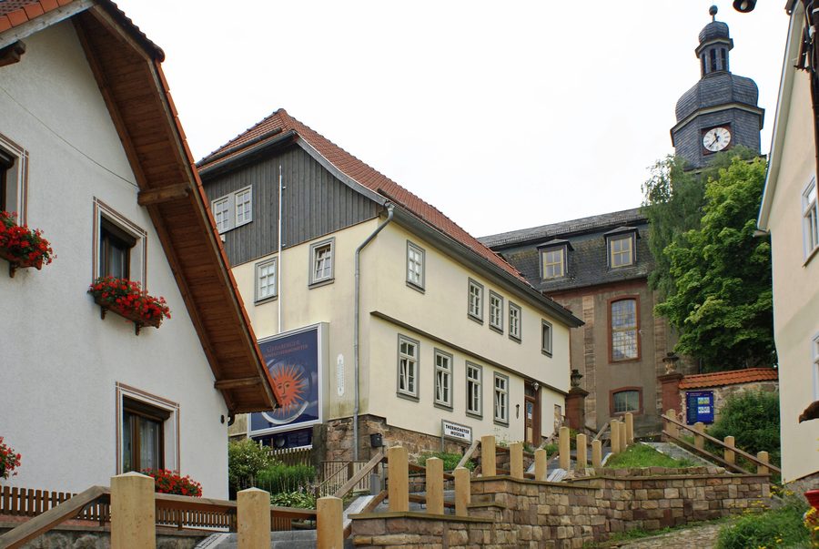
Thermometer Museum and Historic Mill
The German Thermometer Museum Geraberg opened in 2002. The Geraberg sun thermometer is also closely associated with the town: it stands on the north side of the museum. Together, these two named places offer a point of interest for anyone interested in thermometers and technical history.
Another historical trail leads to the Braunstein Mill on the western outskirts of Geraberg, in the district of Arlesberg. Manganese ore was processed there from the second half of the 19th century until 1982. This period gives the mill its own historical context and sets it apart thematically from the thermometer museum. Including both places in your plans gives you two distinct ways to explore Geraberg’s history: the history of thermometers and the former processing of manganese ore.
Weather and Climate Along the Way
The Thuringian Climate Trail begins at Geraberg station. Along the hike, it explains natural phenomena related to weather and climate in an accessible, scientifically sound way. Its particular focus is on combining exercise with learning: natural phenomena become a topic along the way, rather than the route being described solely as a distance to cover.
For rail travellers, a connecting path from the station first passes the German Thermometer Museum behind the Baroque church. It then follows the Gera Cycle Path for a stretch as far as Stocken, where you can join the Thuringian Climate Trail. Before setting out, check the local signposting so you can include this described connection in your plans.
The Thuringian Forest Edge Route also offers another way to explore the surrounding area. As it passes through the Ilm district, it covers 12 kilometres within the municipality of Geratal and runs from Crawinkel through Frankenhain, Gräfenroda and Geraberg. The 12-kilometre figure refers to the section within the municipality, not just the part through Geraberg. This distinction matters when interpreting the route: the distance given for the municipality does not describe the length of the Geraberg section.
Viewpoint and Playground
From Die Buche, a hill at the northern end of Geraberg, you can look out over the town; it is easy to reach on foot. It complements the climate trail’s educational focus with a different emphasis: here, the view of Geraberg takes centre stage, while the trail explains weather and climate phenomena. If a viewpoint is important to you, you can include Die Buche as a destination in your day’s plans.
The playground in Morbacher Park is suitable for small and younger children. Its facilities include a slide, a small climbing wall, swings and a sandpit. These play facilities give a clear idea of what children can expect there, without confusing the park with accommodation or another excursion destination. Geraberg also has a covered seating area where you can take a break.
Include Local Destinations in Your Accommodation Search
When looking for accommodation in Geraberg, you can first consider which local attractions are of particular interest to you: technical history, a hike focused on weather and climate, a view of the town, or a playground for small children. This distinction can help you organise your plans for each day without presenting the different destinations as a single offering.
Discover more destinations: Ilmenau, Frankenhain, Elgersburg, Großbreitenbach, Gehlberg, Frauenwald, Gräfenroda, Bücheloh.
For the regional travel overview: Ilm district.

