
Zierenberg: Half-timbered history and hiking trails
Accommodation in Zierenberg
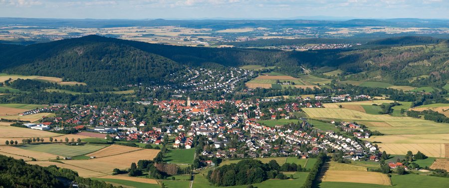
Zierenberg is a small town officially recognized by the state as a health resort, located in Habichtswald Nature Park. It lies in the Warme Valley between the 578-meter-high Dörnberg to the east and the 601-meter-high Bärenberg to the west; Kassel is about 20 kilometers away. Historic buildings, circular trails and a landscape with geological features are key considerations when planning your stay.
Half-timbered buildings, the town church and medieval architectural history
Zierenberg’s historic town hall was built in 1450 by master builder Henrich Brant and is considered the oldest surviving half-timbered town hall in Hesse. The Steinhaus also has a long history: also known as Steinkammer, Steinscheune or Steinwerk, it is considered Zierenberg’s oldest house and was built around 1300.
The Evangelical town church offers a chance to explore its architectural history and historic furnishings. Construction began in 1293 under Landgrave Heinrich I in the Gothic style; the west tower is 45 meters high. The wall paintings date from the 14th and 15th centuries. They were uncovered again in 1934 and then extensively restored from 1958 to 1961 and from 1997 to 2006. If you would like to learn more about the building’s history and the paintings, you can book a guided tour of the church. You can also climb the tower and visit the tower keeper’s room. From there, the view extends to the Dörnberg massif and into the Warme Valley.
Hiking trails of varying lengths
The Habichtswaldsteig Extratour Zierenberg H2 is a 16.5-kilometer circular trail. You can generally start at any point, but the recommended starting point is the information hut at the Dörnberg hiking car park in 34289 Zierenberg. Along the route is a large basalt scree field known as the “Blaue Steine” (Blue Stones). The trail also leads to the three distinctive basalt rocks of the Helfensteine. From there, the view extends across Zierenberg to the Waldecker Land, as well as to the Reinhardswald and Kassel.
The Alpenpfad is a shorter circular trail option: it is easy, five kilometers long and listed as taking about one hour and 30 minutes. Created more than 60 years ago, the trail has no inclines and passes through open scrubland as well as shady stands of spruce and pine. It also offers wide-ranging, varied views of the surrounding area. Compared with the 16.5-kilometer H2, the Alpenpfad offers a shorter route with a stated duration. Check the listed route details before setting out.
Landscape and viewpoints
The landscape of the Dörnberg nature reserve is shaped by formations of Bunter sandstone, Muschelkalk and Tertiary rock. Botanically notable dry grassland communities have developed on the shallow, stony soils. These geological and botanical features complement the basalt formations you can see on the H2.
Above Zierenberg, the Schreckenberg observation tower stands atop the 461-meter-high Großer Schreckenberg. The medieval watchtower fell into disrepair and was rebuilt in 1911; it was renovated in 1991. From its viewing platform, you can enjoy a sweeping view over Zierenberg in the Warme Valley.
Discover more destinations: Fuldabrück, Bad Emstal, Schauenburg, Brasselsberg, Baunatal, Kassel, Helsa, Habichtswald
Go to the regional travel overview: Kassel Region.

