
Grafenried: Forest Trails, Nature and Cycling Routes
Accommodation in Grafenried
Grafenried combines hiking trails, forest landscapes, nature-related attractions and cycling tours. Several trails lead to or through Grafenried, including the E6 European long-distance hiking trail and routes in the Zellertal region. These are complemented by the Asbachtal nature trail, a hiking trail overview map and the Marienkapelle chapel at the village green.
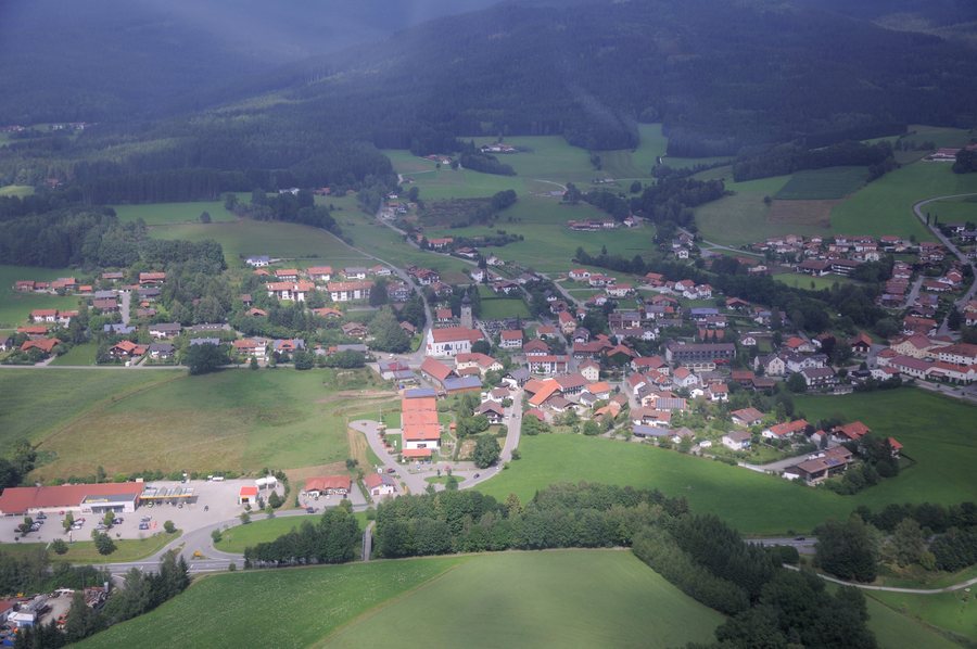 File:2014-08-01 13-05-56 Germany Bayern Drachselsried Grafenried.JPG
Photo: Hansueli Krapf This file was uploaded with Commonist . via Source, CC BY-SA 3.0
File:2014-08-01 13-05-56 Germany Bayern Drachselsried Grafenried.JPG
Photo: Hansueli Krapf This file was uploaded with Commonist . via Source, CC BY-SA 3.0
Hiking between Grafenried, Asbachtal and Frath
The E6 European long-distance hiking trail leads to Grafenried along comfortable forest paths. From Grafenried, the route climbs through mixed forests with an elevation gain of 430 metres to the Burgstall.
The Asbachtal nature trail also reaches Grafenried. The Asbachtal adventure hiking trail is designated as a nature trail and features information boards about nature and the landscape along the Asbach, the habitats of hedgerows, meadows and pastures, near-natural forestry, the Eurasian otter and the cultural landscape.
Another hiking route in the Zellertal region leads from Haufenmühle up to Grafenried along a narrow trail. It then follows the blue Dr 3 trail marking to the Frath plateau, which is reached after about 45 minutes.
Marked trails and orientation on site
Grafenried has a municipal hiking trail overview map. In addition, the hiking trail overview maps of the Drachselsried system provide information about hiking trails, explain the markings, point out special facilities and tourist attractions, and offer recommendations for a nature-friendly stay in the forest and hiking area.
The Asbachtal adventure hiking trail leads to Grafenried and then along the red Dr 58 circular hiking trail via the Chapel Trail to Gabelbrücke. A return variant via Frath and Asbach follows the red Dr 59 hiking trail via the Fritz Chapel to Grafenried and then continues on the red Dr 58 to Drachselsried.
Forest landscape and nature in the surrounding area
In the wider area around Grafenried, around 75 percent of the municipality of Drachselsried is forested. Most of these forest areas are located in the Bavarian Forest Nature Park.
Grafenried on two moderately difficult cycling tours
Grafenried is also connected to regional routes by bicycle. The moderately difficult Drachselsried Höhenrunde is 30.5 kilometres long. It leads via the Schareben mountain hut, the Riedlberg, Mais and Frath to Grafenried and then back to the starting point in Drachselsried.
The Zellertal Tour, also classified as moderately difficult, covers 32 kilometres. It runs from Arnbruck via Drachselsried, Oberried, the Riedlberg, Bodenmais and Böbrach via Frath and Grafenried back to Arnbruck. The two tours differ in their lengths of 30.5 and 32 kilometres, as well as in their starting points and the sequence of stops.
Marienkapelle chapel at the village green
In addition to the trails, the Marienkapelle chapel at the village green is one of the specific destinations in Grafenried. It was built under the direction of the Grafenried village association, with the support of its members and the local population, and was ceremonially consecrated in September. Since then, a Mass has been celebrated there every year to mark the anniversary.
To the overarching travel overview: Drachselsried.

