
Reichertsheim: Rolling Hills and Churches
Accommodation in Reichertsheim
Reichertsheim can be understood through its landscape and religious landmarks. The municipality lies in a valley basin between ancient moraine hills; Reichertsheim is home to a parish church with rich stucco decoration, and the district of Ramsau has a much-visited Marian pilgrimage site. For your orientation, local history, landscape and a described route come together here.
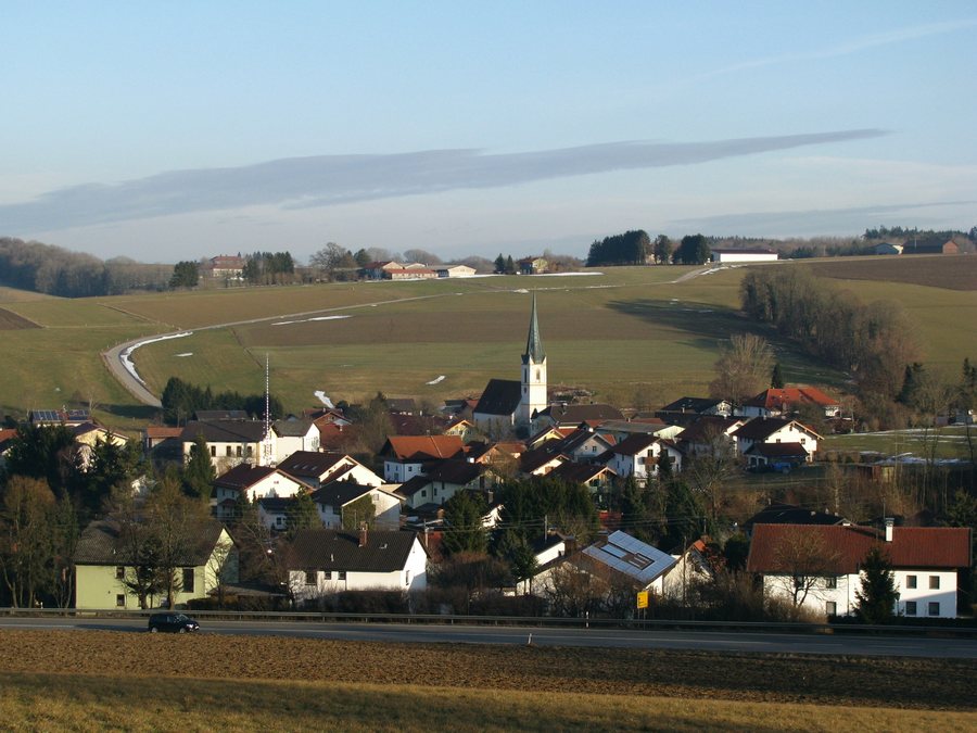
Landscape between the valley basin and ancient moraine hills
The municipality of Reichertsheim, with its 107 officially named districts, lies in a valley basin between ancient moraine hills 70 metres high. Glaciers formed these hills during the Riss glaciation, about 200,000 years ago. The valley basin describes the municipality’s location, while the hills also serve as a geological reference point. The landscape is therefore characterized not only as rolling hill country, but also in terms of its geological history.
For those interested in the landscape when planning a trip, the elevation figures and glacial history provide specific points of reference for the character of the municipality. The description applies to Reichertsheim and its districts as a whole.
Parish church and Marian pilgrimage
The parish church in Reichertsheim was first mentioned in 788 in a property register of Archbishop Arno of Salzburg. The Church of the Assumption of Mary has rich stucco decoration. Together, the date and architectural detail offer two different insights: one into the church’s historical mention, the other into its furnishings.
Another religious landmark is in the district of Ramsau in the municipality of Reichertsheim: there is a much-visited Marian pilgrimage site there. The parish church and pilgrimage site are therefore distinct topics within the municipality, connected by their religious character but each associated with a different place.
Routes and travel orientation
The Panorama Trail heads east via Ramsau and Reichertsheim, then through the hill country and Kirchdorf, before returning to Haag. Its route includes several places and landscape features rather than focusing solely on Reichertsheim. The municipality is about 10 kilometres from the A94 near Heldenstein; this approximate distance provides a first point of reference for getting there.
Mühldorf Am Inn: its own urban and cultural context
The wider destination of Mühldorf Am Inn has other distinct urban and cultural attractions. The 500-metre-long town square is characterized by colourful façades in the Inn-Salzach architectural style. The Salzburg fountain on the town square was a gift from Salzburg Prince-Archbishop Johannes Ernst von Thun in 1692. The two “Traidkästen”, Haberkasten and Kornkasten, with the courtyard between them, were built as grain stores in the 15th century; Haberkasten was later converted into a cultural centre.
The short old-town walk through Mühldorf a. Inn conveys the history and architectural beauty of the district capital. The Nagelschmiedturm, also known as the Munich Gate, stands at the entrance to the town square; it is the oldest building in the town. If you would like to time your stay to coincide with the summer festival, it has been held every year since 1999 during the first two weeks of July in the Haberkasten courtyard. Check the latest event dates.
Discover more destinations: Rattenkirchen.
Back to the wider travel overview: Mühldorf Am Inn.

