
Leins: Maria Hilf Church and Hiking Routes
Accommodation in Leins
In Leins, the history of the Maria Hilf chapel church and several marked hiking routes are central to finding your way around the area. The Leins – Wenns – Arzl-Ried circular hike starts and ends at the church; its distance and elevation gain provide specific points of reference for planning your day. There are also routes with their own names and a designated Swiss-Trac rating. An accommodation listing is also provided with a specific address.
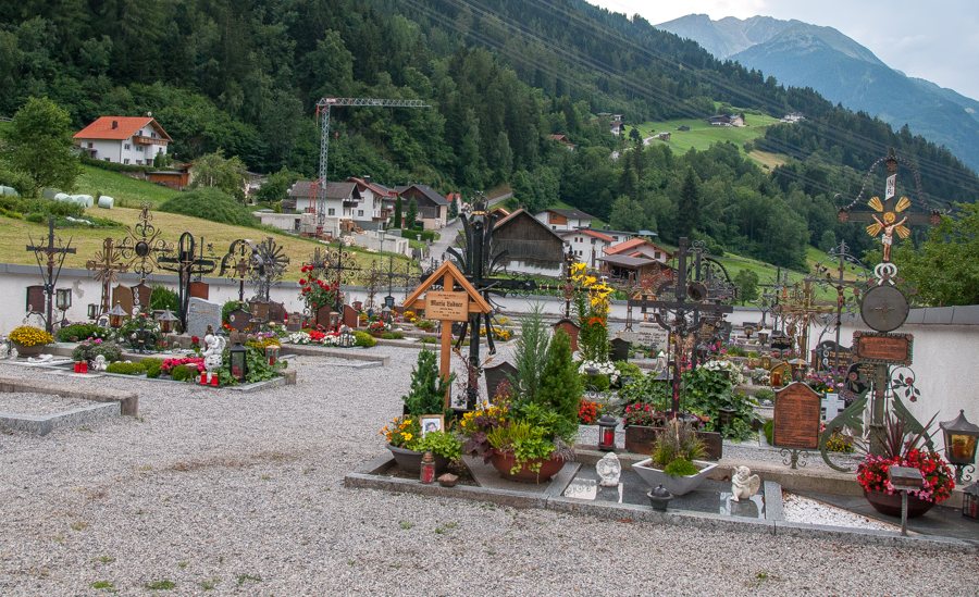
Maria Hilf Chapel Church: History and Features
The present-day Maria Hilf chapel church was built around 1750 to replace an older chapel. It is dedicated to Our Lady, Help of Christians. Another dated detail of its furnishings is the high altar painting: Hans Kapferer from the Sellrain Valley painted it in 1856. The construction history and furnishings can therefore be distinguished chronologically: the church was built, and the altarpiece was created just over a century later.
In 1955, the church was enlarged and given its own cemetery. In 2024, it was restored inside and out, and the altar area was redesigned. Also in 2024, the church was elevated to the status of a branch church. These details describe structural changes and ecclesiastical status as separate aspects of its history. In its list dated 30 June 2025, the Federal Monuments Authority Austria, Tyrol, records the chapel church as protected by decree.
Hiking Routes and Finding Your Way
The Leins – Wenns – Arzl-Ried circular hike is listed as 8.20 kilometres long, with 310 metres of elevation gain and 330 metres of descent. It is designated as a circular route and starts and ends at Leins Church. If you are looking for a hike with a fixed start and end point, both are at the same location; the distance, ascent and descent are listed separately to help you compare the route’s scale. The “Leins Feuerwehr” bus stop is listed as the stop for travelling to this circular hike. Bus services and stops may change, so check the current service before travelling. The listed 330 metres of descent is 20 metres more than the ascent.
Another route is called “Pitzenhöfe – Unterleins and back”; this hike is designated as suitable for a Swiss-Trac. The “Pitzenhöfe – Leins – back” route has its own description: after turning towards Unterleins, it passes the church and a bus stop. When finding your way, check the full route name so you can match the relevant details to the correct route. These names and features offer different points of reference for planning, without assuming a walking time.
Accommodation in Leins
Apart Pitztal is listed at Unterleins 14, 6471 Arzl im Pitztal. Check this address for your desired travel dates through the booking channel.
Discover more destinations: Wald, Ried.
Return to the main travel overview: Arzl Im Pitztal.

