
Log Pod Mangartom: Walk of Peace, Mining History and Mountain Landscape
Accommodation in Log Pod Mangartom
History and Remembrance
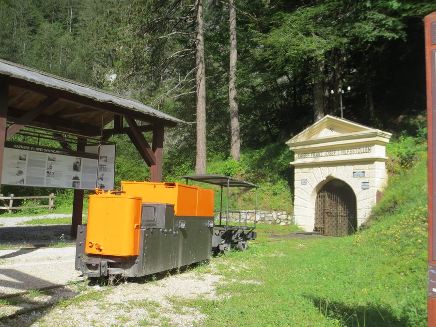
In Log pod Mangartom, the Walk of Peace in the Alps begins at Štoln, the entrance to the former mine, and leads to the Adriatic. Along this route, the Walk of Peace connects remains and memorials of the Isonzo Front. The historic route thus links the former mine entrance with places commemorating the history of the front.
 File:Log pod Mangartom (Bretto) galleria di scarico delle acque delle ex miniere di Cave del Predil - panoramio.jpg
Photo: vuere via Source, CC BY 3.0
File:Log pod Mangartom (Bretto) galleria di scarico delle acque delle ex miniere di Cave del Predil - panoramio.jpg
Photo: vuere via Source, CC BY 3.0
Other destinations include Bovec, Soča and Kobarid.
Settlement and Mining
Gornji Log pod Mangartom and Spodnji Log pod Mangartom belong to a Mediterranean settlement pattern in the park. This consists of groups of farm units, or several farms, located along a transport route. The old Štoln entrance in Log pod Mangartom is connected with a former lead and zinc mine in Raibl (Cave del Predil). The shrine of Saint Barbara in Log pod Mangartom also points to the area's mining history.
The Austro-Hungarian military cemetery in Log pod Mangartom is one of the best-preserved military cemeteries from the First World War in Slovenia.
Regional Cultural Heritage
In the wider regional surroundings of Log pod Mangartom are Wasserleonburg Castle, Maria Graben Monastery, and the ruins of Federaun Castle and Finkenstein Castle. The selection of regional cultural heritage therefore ranges from a castle and a monastery to two castle ruins.
Mountains and Trails
Veliki Snežni Vrh, Briceljk, Rombon and Veliki Vrh are mountains in the vicinity of Log pod Mangartom.
The easy hiking trail from Kluže Fortress to Log pod Mangartom passes through a tunnel on the right bank of the Koritnica and continues to the confluence of the Koritnica and the Nemčlja. Along the trail, you can see the gorge and waterfall of the Nemčlja stream. The route connects Kluže Fortress, the course of the Koritnica and its confluence with the Nemčlja in one continuous stretch. Before setting out on a trail with a tunnel, riverbank, gorge and waterfall, you should check the current trail conditions.
Winter and Water
In favorable snow conditions, an easy cross-country ski trail is prepared in the immediate vicinity of the ski area. The respective snow conditions are decisive when planning cross-country skiing; the trail is explicitly dependent on this condition. Before traveling, it is worth checking the current snow conditions, as the easy trail depends on favorable conditions.
The exit of the canyoning section is at the bridge over the Predelica River in Log pod Mangartom, at an elevation of 650 m. Before canyoning, you can check the current conditions along the planned route.
Getting There
The cross-border Bovec–Tarvisio–Kranjska Gora bus line serves stops in the lower and upper parts of Log pod Mangartom. Before departing, you should check the current timetables and departure times for the cross-border bus connection.
For the broader travel overview: Tolmin.

_galleria_di_scarico_delle_acque_delle_ex_miniere_di_Cave_del_Predil_-_panoramio.jpg)