
Domaniža: Cultural Monument, Landscape and History
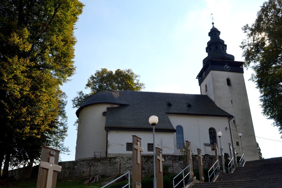
Domaniža lies at the transition between the Strážovské vrchy and the Súľovské skaly, in the Domaniža Basin. You can consider the information on landscape, culture, history and marked trails separately and organise your visit according to the topics that are most important to you.
Landscape and Nature
The Strážovské vrchy Protected Landscape Area lies in the north-western part of the Domaniža planning area; the second level of protection applies there. The geographical setting can be considered separately from the cultural topics and trails. You can set different priorities when planning your trip and weigh the topics individually.
Culture and History
The Roman Catholic Church of Saint Nicholas the Bishop in Domaniža was declared a national cultural monument in 1963; its registration number is ÚZPF 710/1. It stands on the southern edge of Domaniža at the foot of Leska Hill, above the valley.
The remains of the enclosure of the historic cemetery and two of the original three gates have been preserved on the church grounds. A Slavic settlement dating from the 11th to the 12th century was identified in the Lazy and Brezné districts of Domaniža. Archaeological traces indicate that settlement in Domaniža dates back to the Late Bronze Age.
Historically, wooden vessels were made in Domaniža, linen, carpets and tablecloths were woven, and slippers, krpce and Haleny were sewn. Bricks and clay stoves were produced in a factory built by Count Erdődy of Hlohovec.
In the historical information, you can distinguish between the religious building, settlement remains and craft production. The dates and preserved structural elements each represent a separate historical layer.
For accommodation in Domaniža, travel dates, room category and cancellation conditions constitute three different offer categories. Depending on whether culture, landscape, hiking or cycling is the main focus, you can assign different weight to each of these details.
Marked Trails
The marked hiking route 2742 connects Fačkov with Kľak; the Domaniža–Fačkov section is marked by Považská Bystrica. The Domaniža–Kľak hiking route is 12.6 km long. The waypoints named on route 2742 include Kľak, Pod Kľakom, Sedlo Malého Kľaku, Suchá dolina and Fačkov.
The information on the connection, marking, waypoints and length describes different features of the hiking route. For your planning, you can first check whether the desired route passes through the named places and what the extent of the Domaniža–Kľak connection is.
The stated length and named waypoints help you consider the hiking route in terms of its extent and stops. The two routes belong to different activity types. You can first distinguish between hiking and cycling and then consider the connection, the named waypoints or the extent.
For a comparison of places, Horna Marikova, Papradno and Sádočné are also available.
Regional cycling tourism route 2304 connects Považská Bystrica with Domaniža.
For the higher-level travel overview: Považská Bystrica District.
Check prices, availability and amenities for your travel dates directly on Booking.com.
View accommodation and offersAdvertisement · Affiliate link to Booking.com
