
Vyšný Klátov: Trails, Peaks and Local History
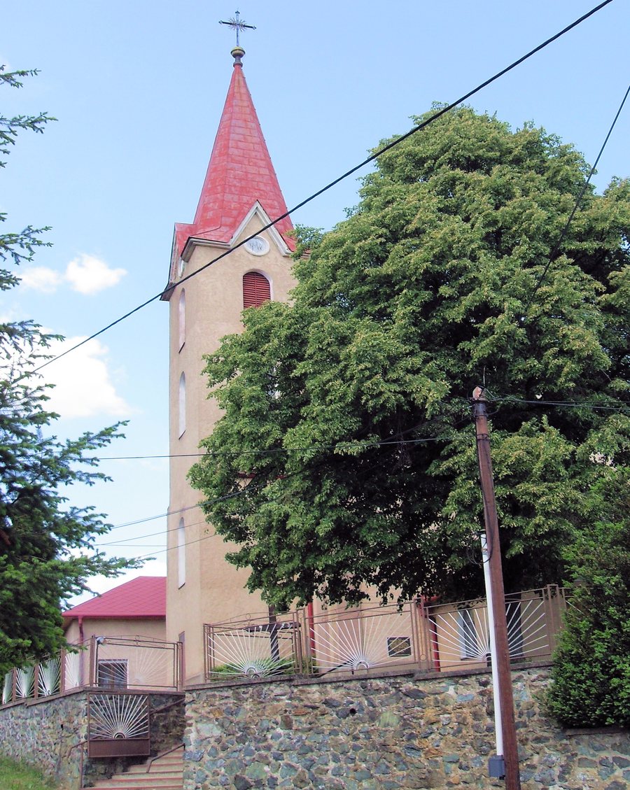 File:Vyšný Klátov Farský kostol Najsvätejšej Trojice 1.jpg
Photo: Rauenstein via Wikimedia Commons, CC BY-SA 3.0
File:Vyšný Klátov Farský kostol Najsvätejšej Trojice 1.jpg
Photo: Rauenstein via Wikimedia Commons, CC BY-SA 3.0
Two marked hiking routes with different destinations begin in Vyšný Klátov: a blue-marked route leads to the nearby Jahodná sports and recreation centre, while a yellow-marked route leads to the Lajoška mountain hut.
Trails and Educational Trail
The yellow route continues to Železný vrch at an elevation of 817.5 metres. The Lajoška mountain hut is located in the vicinity of Vyšný Klátov, below the summit of Predná Holica at an elevation of 908 metres. A blue-marked cycling route also passes through the village.
The Klátovské meteority educational trail also begins in Vyšný Klátov; there are four information panels in the village. It is 2.2 kilometres long and has an elevation difference of 60 metres. The educational trail is a self-guided, linear, bidirectional and year-round hiking trail. In terms of content, it is dedicated to astronomy and is connected with the meteorite fall of 28 February 2010 in the municipality of Vyšný Klátov.
The different types of routes can be considered separately when planning: the destination, marking and type of activity are the main factors for the routes, while the educational trail also involves its length, elevation difference and direction of travel.
Landscape and Geographical Context
Vyšný Klátov is located in the Volovské vrchy mountains, which form part of the Slovenské rudohorie mountain range. The cadastral territory includes part of the Volovské vrchy Special Protection Area. The village lies at the transition between the north-western part of the Košická kotlina basin and the Slovenské rudohorie mountain range, in the source area of the Myslavský potok stream. At 947 metres, Predné Holisko is the highest peak in the cadastral territory of Vyšný Klátov.
History and Church
The history of Vyšný Klátov includes a period as a German colony from 1317 to 1773. It was connected with the exploration of mineral resources as well as the extraction and processing of iron ore.
The Church of the Most Holy Trinity was built in 1869 on the site of an older church. It incorporates the tower of the older church and contains historicist Art Nouveau altars from the first half of the 20th century.
Folk Culture and Village Life
The Folk Culture Mini-Museum was established in 2001 in a former municipal smithy. It displays historical furniture, household and agricultural objects, homemade folk costumes and embroidery.
The ŽIJEM festival in Vyšný Klátov continued a more than ten-year tradition of CHRISTILAND. The Koinonia Ján Krstiteľ community centre was founded in 1994 in eastern Slovakia near Košice and offers spiritual and recreational activities.
Getting There
The bus connection to Vyšný Klátov is operated by Eurobus Košice. For a further comparison with another village, you can also visit Bukovec.
When choosing accommodation in Vyšný Klátov, travel dates, room category and cancellation conditions form a separate decision level. For stay planning, you can weigh this information according to your travel plans. The period, room and conditions remain clearly separate and can be considered independently of personal preferences. The three details concern different aspects and can be clearly compared side by side.
For the broader travel overview: Košice-Okolie District.
Check prices, availability and amenities for your travel dates directly on Booking.com.
View accommodation and offersAdvertisement · Affiliate link to Booking.com
