
Sardinia between nuraghi, nature parks and coastlines
Accommodation in Sardinia
Sardinia stretches from Bronze Age nuraghi to vast coastal and natural areas. Su Nuraxi di Barumini is Sardinia’s best-known example of a Bronze Age defensive complex of the nuraghe type. Su Nuraxi di Barumini was inhabited from the construction of its nuraghe in the 2nd millennium BC until the 3rd century AD.
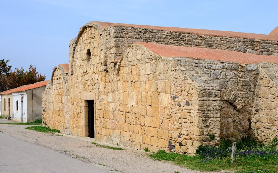 File:Church San Giovanni di Sinis - Cabras - Sardinia - Italy - 04.jpg
Photo: Norbert Nagel via Wikimedia Commons, CC BY-SA 3.0
File:Church San Giovanni di Sinis - Cabras - Sardinia - Italy - 04.jpg
Photo: Norbert Nagel via Wikimedia Commons, CC BY-SA 3.0
Culture and history
In Cagliari, the National Archaeological Museum displays more than 4,000 objects spanning almost 7,000 years, from prehistory to the Early Middle Ages. The Cittadella dei Musei is the largest museum complex in Cagliari and throughout Sardinia. Its exhibition spaces incorporate Roman cisterns, Spanish fortifications and Piedmontese prisons.
In central Sardinia lies Nuraghe Nolza, one of the largest and best-preserved prehistoric monuments on the island. Its central tower is now about 13 metres high and rises above a surrounding settlement of huts extending over two and a half hectares. The subregion Nuoro is also relevant for the regional context.
Porto Flavia consists of superimposed tunnels excavated into the mountain. Minerals were transported through them from the shafts to the ships anchored off the roadstead of Pan di Zucchero; today, Porto Flavia is a visitor route focusing on the history of mining technology. Open Mar – Miniera Argentiera is an open-air mining museum on the northwest coast of Sardinia, among disused facilities, an uninhabited village and the sea.
Samugheo in Mandrolisai, in the province of Oristano, is a Sardinian centre for the production of carpets, tapestries and traditional clothing as part of a weaving tradition handed down for centuries. Murats in Samugheo is a regional museum of textile art, displaying textile works from throughout Sardinia. Tessingiu renews Samugheo’s textile tradition every year with a specialist exhibition and trade fair. Samugheo is also known for pecorino, good wine and breadmaking; in October, a folk festival is dedicated to bread.
An aristocratic residence with a palace, garden, large courtyard and agricultural outbuildings houses a museum complex of the same name with archaeological, historical-archival and ethnographic departments.
Nature and trails
Tepilora Regional Nature Park covers almost 8,000 hectares of forests, trails and waterways stretching from the mountains of Barbagia to the coastal wetlands. The Torpè–Monte Nurres route ends with a trail accessible only on foot and equipped for wildlife observation. From there, the 360-degree view reaches Monte Tepilora, the Rio Posada valley, the plain of Siniscola and the sea.
The Rio Posada in Tepilora Nature Park has a meandering form unique to Sardinia and is used by canoeists and birdwatchers. The updated Rete Escursionistica della Sardegna connects the trail network with the Cammini di Sardegna and improves the usability of the routes for residents and visitors. The RES allows the island to be explored on trails suitable for everyone from beginners to experienced hikers.
The trail at Punta Giglio uses nine multilingual information panels and a Braille panel to explain vegetation, history, wildlife and geomorphology. In the National Park of the Gulf of Orosei and Gennargentu, peaks, pastures, plateaus, gorges, ancient forests, sea cliffs, caves and beaches come together. There are trails there for trekking and mountain bike excursions.
Molentargius-Saline Regional Park was established in 1999 to protect one of Europe’s most important resting and breeding areas for waterbirds. In Porto Conte Regional Park, 35 mammal species and 150 bird species have been recorded. The different landscape forms and types of trails can be categorised according to nature observation, hiking and cycling.
Coast and sea
Asinara Island can be reached via a public sea connection operated by Compagnia di Navigazione Delcomar on the Porto Torres–Cala Reale route. Visitors arriving by ferry at Cala Reale receive information from the local guides and visitor centres about possible activities and visits in Asinara National Park.
In Zone B of the Asinara Marine Protected Area, diving, swimming, sailing or rowing, authorised commercial fishing, snorkelling and fishing tourism are permitted. La Maddalena Archipelago National Park covers more than 20,000 hectares on land and at sea, 180 kilometres of coastline and more than 60 islands. Its seabed offers opportunities for diving.
Capo Coda Cavallo Marine Protected Area covers 15,000 hectares of clear waters, coves, white beaches, islands and lagoons. Cala Brandinchi has very shallow water extending for several dozen metres, rocky areas with marine fauna and opportunities for snorkelling. Diving centres accompany visitors to dive sites in the Capo Coda Cavallo Marine Protected Area.
Behind La Pelosa are gentle dunes covered with juniper.
Getting around
The Trenino Verde is currently considered a network of four routes totalling 163 kilometres; the routes connect Sardinia’s coast and inland areas and are linked with boat trips as well as excursions on foot, by bicycle and on horseback. In Tepilora Nature Park, canoes or SUPs are rented with the assistance of a FICK instructor.
To the higher-level travel overview: Italy.
More destinations
More places within the same destination:

