
Kemence: Hiking Trails, Forest Railway and Forestry History
Accommodation in Kemence
Explore Kemence during your stay in a variety of ways: follow marked hiking trails with stated route details, or visit the Kemencei Erdei Múzeumvasút and its exhibition on the narrow-gauge railway and forestry history. When planning, it is worth distinguishing the hiking routes by their markings, destinations and stated figures. The seasonal forest railway offers another way to experience the landscape, while the exhibition focuses on cultural history.
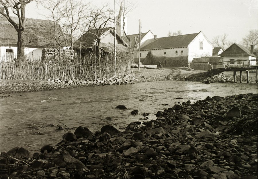 Kemence stream with the Roman Catholic Church of the Nativity of Mary in the background
Photo: Photo: FOTO:Fortepan — ID 95550 : Adományozó/Donor: Schermann Ákos. archive copy at the Wayback Machine
Kemence stream with the Roman Catholic Church of the Nativity of Mary in the background
Photo: Photo: FOTO:Fortepan — ID 95550 : Adományozó/Donor: Schermann Ákos. archive copy at the Wayback Machine
Hiking trails and their routes
The municipal hiking information lists a yellow-marked trail that starts in the centre of Kemence and leads to Diósjenő via Tótok útja, Kámor-hegy and Závoz-tető. The route is listed as 20 km and 5.5 hours. The sequence of named waypoints and the destination make the route clear; both figures apply to this yellow hiking trail.
Another municipal route description leads from Vilati-Feketevölgy-Panzió via Drinó-patak, Dosnya-nyereg and Nagy-Oros-bérc towards Mathias Panzió in Királyháza. It is marked blue and green-plus and is listed as 15 km. Check local conditions before setting out. The route’s direction towards Királyháza and its markings distinguish it from the yellow trail to Diósjenő.
Blue and blue-plus-marked hiking trails also lead from Vilati-Feketevölgy-Panzió towards Hamuház, Hangyás-bérc and Nagy-Hideghegyi turistaház. You can identify these directions by the stated marking colours and names. When choosing a trail, consider its destination and colour marking together so that the details match the route you intend to take.
For a comparison by distance, the yellow trail’s 20 km can be set against the 15 km route towards Mathias Panzió. The 5.5-hour estimate applies to the yellow trail to Diósjenő. This keeps each route’s distance, destination and time estimate together, rather than transferring figures between different hikes.
Forest railway and exhibition
The Kemencei Erdei Múzeumvasút runs for about 4 km through varied landscapes and operates from early spring to late autumn. Its approximate length and seasonal operation offer two different points of reference for planning. Check the forest railway’s operating schedule before your trip. Unlike the hiking trails mentioned above, this is a railway route, so its seasonal operating period is especially important.
The railway’s history is also part of the visit. The Kemencei Erdei Múzeumvasút opened in 2000 on the northern part of the former sawmill site in Csarna-völgy. Its exhibition covers the Börzsöny narrow-gauge railway and forestry history. Alongside the seasonal train ride, the exhibition focuses on two specific subjects: the regional narrow-gauge railway and the history of forestry. If you are interested in technological and cultural history, you can explore these topics as a separate focus alongside the hiking trails.
Kemence in the Pest travel region
Within the wider Pest travel region, the part of the highlighted Danube Bend tourism area that lies in Pest County includes the entire Danube Bend, the Visegrád Mountains and the Börzsöny Mountains. This regional context places Kemence’s specific destinations and route details within a broader landscape. Each of the hikes mentioned leads to its own destination, while the description of the tourism area refers to the wider region. You can therefore consider local activities and the regional context as different scales for your stay.
For the wider travel overview: Szobi.
More destinations
More places in the same travel region:
