
Westfeld: Hotels and Accommodation
Accommodation in Westfeld
Winter
At the Hochsauerland cross-country skiing centre in Westfeld-Ohlenbach, machine-groomed trails are available for classic technique and skating. Trail information includes maps, distances, snow depth and difficulty level.
You are planning a stay in Westfeld and would like to find accommodation for it.
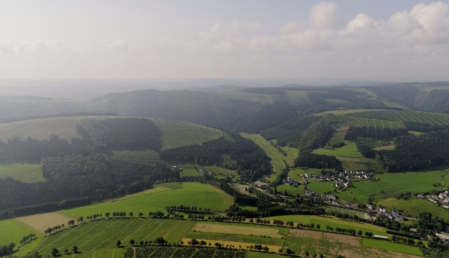 File:Schmallenberg-Westfeld Sauerland Ost 040 pk.jpg
Photo: Teta via Wikimedia Commons, CC BY-SA 3.0
File:Schmallenberg-Westfeld Sauerland Ost 040 pk.jpg
Photo: Teta via Wikimedia Commons, CC BY-SA 3.0
Westfeld-Ohlenbach offers a Sauerland landscape with green meadows, sunny valleys and extensive forests, which are used for hiking in summer. In winter, there are groomed cross-country ski trails and winter hiking paths.
Hiking
The Kahler Asten Trail is considered a challenging premium circular trail covering 16.5 kilometres. It starts at the upper village park in Westfeld. Features of the trail include the high heathland on the Kahler Asten, an old quarry for road-building material and views from the Knochenspitze.
The Schwedensteig-Heidenstrasse is a 15-kilometre circular trail. It starts at St. Blasius Church in Westfeld and follows the historic Heidenstraße, offering views across the Sauerland landscape.
Village character
Westfeld-Ohlenbach has a village character shaped by half-timbered houses and received the Bundesgolddorf award in 1975.
Geographical location
The Vordere Hohe Knochen is located near Westfeld.
The Hintere Hohe Knochen is also located near Westfeld.
The Saukopf is located in the area surrounding Westfeld.
The Ruhberg is also located in the area surrounding Westfeld.
Biedenkopf Castle is located in the wider regional surroundings of Westfeld.
To the higher-level travel overview: Schmallenberg.
Other destinations
Other places within the same destination:

