
Störnstein: Church, Granite and the Bockl Cycle Path
Accommodation in Störnstein
Störnstein can be understood through its distinctive local features: these include the history of St. Salvator Church, former granite quarries at Gügel, and paths for walking or cycling. If you are looking for accommodation for your stay, these topics can help you see how the town fits with your own travel plans.
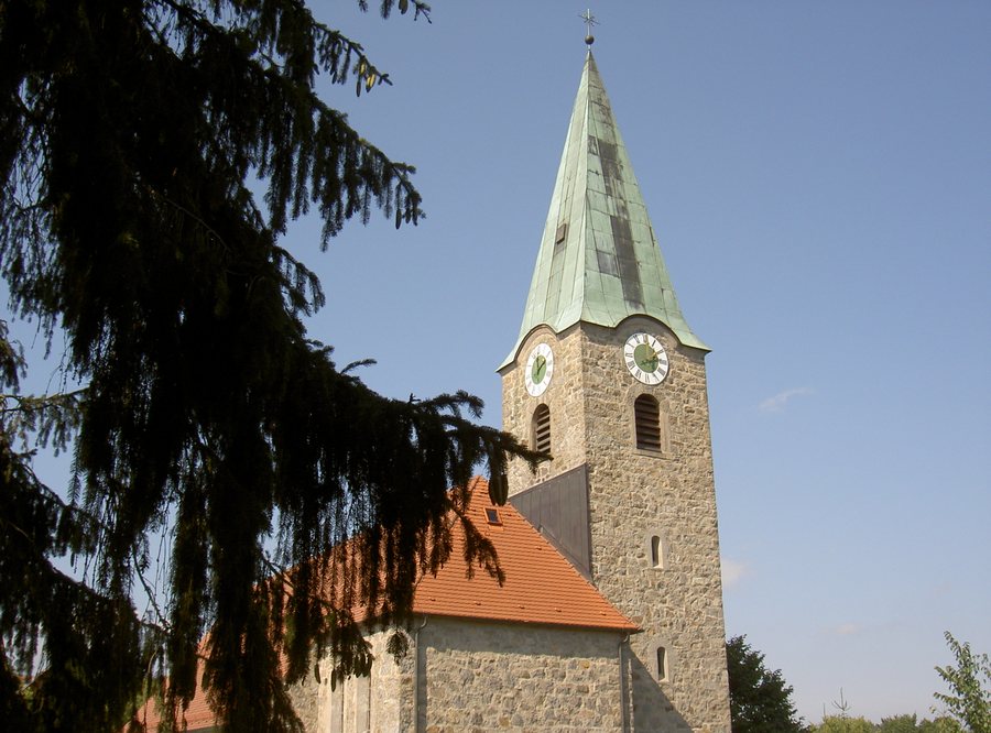
Local history at St. Salvator
The Catholic Church of St. Salvator was built in 1934, dedicated on October 20, 1934, and consecrated in 1935. Until 1934, the Chapel of St. Catherine stood on its site. It was the last remaining part of Störnstein Castle, which was destroyed during the Thirty Years’ War. The transition from the castle chapel to today’s church makes St. Salvator a tangible point of reference for the town’s history.
The former communal bakehouse is also a worthwhile stop in Störnstein. Along with the church, it offers another historic site through which to explore the town’s past. If you like to combine your trip with cultural and historical interests, these two destinations provide useful guidance for your choice.
Granite landscape and hiking trails
At Gügel, on the opposite southern side of the valley from Störnstein, several small former granite quarries lie at an elevation of 498 metres. Here, the area’s geological character meets the former use of its stone. Gügl can be climbed, but the view from there is very limited. If you are expecting a sweeping panorama on your outing, take this limitation into account when planning.
A geological and historical hike in Störnstein leads to the village church of St. Salvator, up to the plateau of the former Störnstein Castle, around the distinctive granite spur, and to the road cutting at the western edge of the town. It then continues to the former quarries at Gügel and on to Bühl. The stops combine local history and geology in a single described hike.
The “Störnsteiner Steine” circular hiking trail is about 4.8 kilometres long. It includes 125 metres of ascent and has an elevation difference of 73 metres. These figures give you concrete points of reference for comparing the trail’s length and elevation profile with your own hiking plans.
The Bockl Cycle Path and the wider travel destination
Störnstein is on the Bockl Cycle Path. In the wider travel destination of Neustadt An Der Waldnaab, the Bockl is a 52-kilometre route from Neustadt an der Waldnaab to Eslarn along a historic railway line. It can be used on foot, by bicycle or on inline skates. The Bockl is paved for most of its length and free of traffic; gradients on the route rarely exceed 3 percent.
In the wider travel destination of Neustadt An Der Waldnaab, the district offers activities including hiking, cycling, museum visits and swimming in numerous bathing waters. This regional context complements Störnstein’s local features, but does not replace them: the church, the quarries mentioned above and the local circular hiking trail are specific to Störnstein; the district’s described offerings belong to the wider destination.
Assessing Störnstein as a place to stay
When choosing accommodation in Störnstein, you can focus on the activities that matter to you during your stay. The local history at St. Salvator, the granite landscape at Gügel, the circular hiking trail and the Bockl Cycle Path offer a range of themes. If hiking is your main interest, the distance and elevation details for the “Störnsteiner Steine” circular trail can help you assess it. If your decision is primarily about cycling, the Bockl Cycle Path is the relevant local feature; for history and geology, the church, castle connections and quarries are the main points of interest.
Discover more destinations: Eslarn, Vohenstrauß, Neustadt An Der Waldnaab, Floß, Waidhaus, Pleystein, Theisseil, Eschenbach In Der Oberpfalz.
View the wider travel overview: Neustadt an der Waldnaab District.

