
Holzschlag: Hiking Trails, Forest and Wutach Gorge
Accommodation in Holzschlag
Holzschlag offers you several ways to combine nature, activity and regional history. The trails begin, among other places, at the village square or at the Holzschlag hiking car park. For planning your day, there is an approximately two-kilometre panorama circular trail, a path to a shelter, a cycle path along a historic railway line and access to the Wutach Gorge.
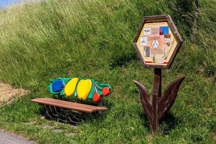 File:Bonndorf im Schwarzwald, Holzschlag, Via Apis – Welt der Biene -- 2025 -- 7794.jpg
Photo: Dietmar Rabich via Source, CC BY-SA 4.0
File:Bonndorf im Schwarzwald, Holzschlag, Via Apis – Welt der Biene -- 2025 -- 7794.jpg
Photo: Dietmar Rabich via Source, CC BY-SA 4.0
Key facts on the subject
- Holzschlag lies at an altitude of 816 metres amid red sandstone and granite.
- Dense forests surround the village.
- The Via Apis bee nature trail is an approximately two-kilometre, pram-accessible panorama circular trail starting at the Holzschlag hiking car park.
- There are 15 information panels along the Via Apis; at the starting point, there is also a show beehive, a playground, an information centre and parking spaces.
- Circular trail no. 2 leads from the village square via the bee nature trail as well as the Vorderbergweg, Kohlweg and Bruggenweg to the Glaserbuck shelter, which is exclusively a simple shelter.
- Circular trail no. 3 Holzschlag–Gündelwangen can be reached from Neustadt or Bonndorf by bus route 7258.
- The Bähnle cycle path follows the historic railway line to Holzschlag and then runs above Gündelwangen past horse pastures, offering a view of the Wutach Gorge.
Hiking trails for different day plans
If you are travelling with a pram or are looking for a manageable themed trail, the Via Apis is the clearly described circular trail in Holzschlag. Its approximate length of two kilometres, the information panels and the playground at the starting point make it easier to plan a short outing. The show beehive and the information centre complement the trail’s thematic focus.
For a hike with several named trail sections, circular trail no. 2 is suitable as a point of reference. It starts at Holzschlag village square, leads via the bee nature trail and connects the Vorderbergweg, Kohlweg and Bruggenweg with the Glaserbuck shelter. As the Glaserbuck shelter is exclusively a simple shelter, you should plan to bring your own provisions and any other equipment you need for the trail.
Cycle path and access to the Wutach Gorge
The Bähnle cycle path offers its own view of the surrounding area. It initially follows the historic railway line to Holzschlag. The route then leads above Gündelwangen past horse pastures and opens up a view of the Wutach Gorge. This allows you to experience the landscape from a different perspective than on the local hiking trails.
There is also access to the Wutach Gorge from the Dorfplatz Holzschlag motorhome parking area. This specific access point is relevant to your route planning if the gorge is to be part of your outing. For travelling to a circular trail, you can also consider bus route 7258: circular trail no. 3 Holzschlag–Gündelwangen can be reached from Neustadt or Bonndorf on this route.
Holzschlag between forest and history
The altitude of 816 metres and the surrounding dense forests shape orientation in the area. At the same time, Holzschlag points to an older history of settlement and craftsmanship. The small hamlet of Glashütte belonged to Holzschlag for a time, is documented as early as 1296 and received its name from a glassworks that operated there. This historical connection gives the name Glashütte a specific regional reference.
The associated municipality also adds a culinary aspect to your travel planning. In Bonndorf in the Black Forest, Schwarzwaldimkerei & Brennerei Herb produces honey specialities, fruit brandies, honey schnapps and liqueurs from regional ingredients. The farm shop’s range includes honey, bee and spirits products. If you are looking for accommodation in Holzschlag, you can consider these local destinations separately from your respective hiking or cycling tour. For further orientation in the surrounding area, Saig is also worth considering.
FAQ
How high is Holzschlag?
Holzschlag lies at an altitude of 816 metres. The village is situated amid red sandstone and granite and is surrounded by dense forests.
Is there a pram-accessible trail?
Yes. The Via Apis bee nature trail is an approximately two-kilometre, pram-accessible panorama circular trail. It starts at the Holzschlag hiking car park.
What is there along the Via Apis?
There are 15 information panels along the themed trail. At the starting point, you will also find a show beehive, a playground, an information centre and parking spaces.
Where does circular trail no. 2 begin?
Circular trail no. 2 begins at Holzschlag village square. It leads via the bee nature trail, the Vorderbergweg, the Kohlweg and the Bruggenweg to the Glaserbuck shelter.
Can Holzschlag be reached by bus?
Circular trail no. 3 Holzschlag–Gündelwangen can be reached from Neustadt or Bonndorf by bus route 7258.
Is there access to the Wutach Gorge?
There is access to the Wutach Gorge from the Dorfplatz Holzschlag motorhome parking area. The Bähnle cycle path also offers a view of the gorge above Gündelwangen.
To the overarching travel overview: Lenzkirch.

