
Eidenberg: Hiking Trails and Chapels
Accommodation in Eidenberg
For a stay in Eidenberg, marked circular hiking trails and several named cultural sites offer specific points of interest. Two trails can be compared by their length, route type and walking time: the Gymnastics Trail and the Eidenberg Höhenweg. Other sites include the Expositur Church in Wies, the so-called “Headache Stone” near the Wolfgang Chapel, and the Gressn Chapel with its soldiers’ memorial. This gives you different trail features and cultural themes to consider when planning your trip.
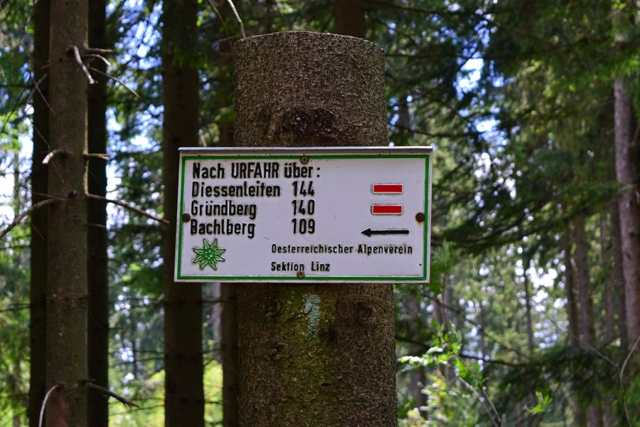 File:Eidenberg - Kammerschlag - Wegweiser nach Urfahr.jpg
Photo: Haeferl via Wikimedia Commons, CC-BY-SA-4.0
Hiking Trails: Stations or a Circular Route
The Gymnastics Trail is about 1.6 kilometres long and has 18 stations. It starts and ends at the Eidenberger Alm inn and is accessible to wheelchair users. It is also known as Austria’s “1st Gymnastics Hiking Trail.” Its length, stations and named start and end point give you several specific features to base your choice on. If you would like to include a tour with stations and a set start and end point in your plans, these details are particularly helpful.
The Eidenberg Höhenweg is a circular trail about 8.5 kilometres long. The estimated walking time is approximately 2.5 hours. This gives you both an approximate distance and a time estimate for the route. This is a guideline: when planning, you can use the walking time as an approximate indication of the time needed for the tour, while also bearing in mind that the route is described as a circular trail.
The two trails differ considerably in length and format. The Gymnastics Trail is described as having 18 stations and starting and ending at the Eidenberger Alm; for the Höhenweg, the circular route, approximate length and walking time are specified. Eidenberg also has other marked circular hiking trails. You can therefore narrow down your options based on whether you prefer stations, a particular distance or the character of a circular route. A specific length and walking time are given for the Höhenweg, while the stations and named start and end point are the main points of reference for the Gymnastics Trail.
Free hiking maps are available at the Eidenberg municipal office and at local inns. If you would like to plan your tour using a map, this can be a practical starting point for finding your way. Briefly check that maps are available before you travel. This lets you factor in obtaining one without confusing the features of the individual trails.
Chapels and Local Places of Remembrance
The Expositur Church dedicated to the Divine Saviour in Wies was consecrated in 1749. This specific date places it in its historical context and offers a clear point of reference if you are interested in the village’s religious buildings. The year also sets this information apart from the details about the hiking trails: here, the focus is on the history of a named church building, not on planning a route.
The so-called “Headache Stone” is located near the Wolfgang Chapel. It is a slanted stone slab with a hemispherical hollow. The name and unusual shape give you two different points of reference: the stone’s name and its specific appearance. Its location in relation to the Wolfgang Chapel is also helpful when identifying the site.
The Gressn Chapel with its soldiers’ memorial stands at the edge of the forest beside the hiking trail from Gressn towards Eidenberg. Its location by the trail and forest edge sets it apart from the other two cultural sites. This lets you distinguish the sites by their respective points of reference: the church in Wies is defined by its consecration date, the Headache Stone by its proximity to the Wolfgang Chapel and its shape, and the Gressn Chapel by its position beside the hiking trail and its soldiers’ memorial.
Together, these sites and trails offer a range of specific points of interest for choosing a stay: trails with information about distance and walking time, a gymnastics hiking trail with stations, and churches and places of remembrance with their own historical or local points of reference. You can weigh this information according to whether hiking or visiting the chapels and their distinctive features is more important to your travel plans.
Discover more destinations: Weignersdorf, Sankt Magdalena, Zwettl An Der Rodl, Schild, Bad Leonfelden.
To the regional travel overview: Urfahr-Umgebung.

